The Walk through an ancient
Chestnut Forest


Ahead of us we notice trees with yellow/orange foliage.

We are approaching the chestnuts forest of el Bosque de Cobre.


We drive out of the pine forest and into the chestnut forest.


In the distance we see smoke rising.
Which you can observe frequently in autumn as gathered tree waste is burned.

Around another curve, and the village of Pujerra is ahead of us.


From this point we looked across the upper river valley
(Valle del Alto Genal).


And right above the Pujerra-Jubrique road,
the majestic old chestnut trees.

Sunlight reflecting through the trees

At the fountain we turned right to the upper road. It is here where we parked the car and from where we commenced our walk.

Unfortunately there was no signpost directing us to an official route into the chestnut forest, but their will always be a friendly villager who will come to your aid.

This sign tells you that this is a route from Pujerra to Estepona.
We followed it for a short distance.

A small path leads uphill.

Soon you will find yourself surrounded by rather large chestnut trees.

These trees have been pruned and cared for, for many many years.


Standing next to a majestic looking chestnut tree,

made me feel so humble and I started to wonder,

how old must this tree be?
Chestnut trees, Castañas, (Castanea sativa)
can reach over 1000 years old.

How many generations have cared for it?
Most probably it was the Romans who brought them to the Iberian Peninsula.

How many have stood here before me and looked up?

His roots still strongly holding on!

How many families have earned a livelihood?
Not only the nuts are used in many culinary products and at some time formed part of the staple diet, but also the wood is used for making furniture, barrels etc. or simply for firewood.

Here they are still standing strong,


thanks to the people who care for them and admire them.

On weekends you find families taking a stroll.

Fallen leaves are everywhere.

Sometimes you hardly can see the road.

At the next crossing we follow the path to the right uphill.

And at the top you come to a clearing where you see some radio masts.

From here we walked to the right past a yellow building.


Most of the harvest had been gathered by this time.


The chestnut trees (Castañas) thrive on the hilly slopes and acidic soils of the
Chestnut Forest

Prologue:


Pujerra is situated at an altitude of 769 meters and within El Bosque de Cobre, with about 300 inhabitants it is one of the smaller villages in the Alto Genal river valley in the Serranía de Ronda.
The villages long history, dates back to the times of the Visigoths, Romans, Moors and Christians until the present day.
On a beautiful November day we decided to drive to the village of Pujerra in the Serranía de Ronda, where we wanted to experience the mystique of the ancient chestnut forest.
It is in the autumn that the Copper Forest (el Bosque de Cobre) of the Serranía de Ronda, comes alive. Not only is the harvesting of chestnuts in full swing, and many businesses of the region of the Genal river valley depend on it, but also the natural phenomena, when the leaves of the chestnut trees change their colours from green to yellow to orange and brown, can be observed.
The Genal valley is famous for its chestnut trees which have been cultivated for hundreds of years. Although most of the area is not public, it is owned by private businesses which provide a lot of work and sustenance for the local people, there are numerous footpaths and walking tracks, which are signposted.

Pujerra is situated at an altitude of 769 meters and within El Bosque de Cobre, with about 300 inhabitants it is one of the smaller villages in the Alto Genal river valley in the Serranía de Ronda.
The villages long history, dates back to the times of the Visigoths, Romans, Moors and Christians until the present day.

Directions:
- To get to the village of Pujerra, you head for Ronda A-397 via San Pedro de Alcántara. It takes you about 1 hour when coming from Marbella.
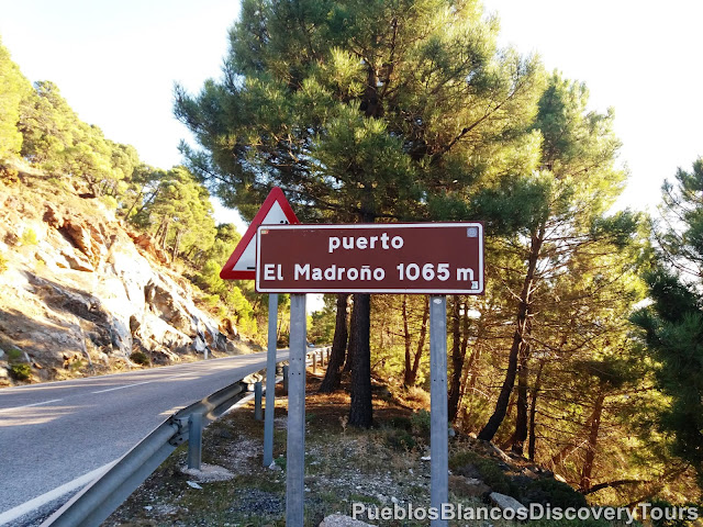
- After about 40 minutes you reach the mountain pass of Puerto el Madroño, it is here where signs point you towards Pujerra.
- You follow this windy road (Camino de los Anadillos) for about 20 minutes before arriving in the pueblo. It is a very scenic drive.
- At the entrance of the village we turned right to the upper road.
- It is here where we parked the car and also we found a sign directing us towards the ancient chestnut forest. (Camino de Pujera a Estepona)
- The Walk, a circular route of about 4,5 km, is a leisurely walk on a forest road. Ideal for families.
- We took 3 hours including time for a picnic.

We left the Ronda highway behind us and follow a small tarmac road which leads us into a pine forest.

At the crossroad you find an information board about some of the wild birds which can be seen in the Serranía de Ronda.

This route to Pujerra is probably less well known than via Igualeja, but certainly worth it because of the lush vegetation and for the tranquillity and its scenic views.

We stopped briefly at a clearing and as we looked along a valley we were able to see the coast in the distance.

Ahead of us we notice trees with yellow/orange foliage.

We are approaching the chestnuts forest of el Bosque de Cobre.

On the photo below the view north/east and the Sierra de las Nieves and we are able to see the Ronda road.

We drive out of the pine forest and into the chestnut forest.


In the distance we see smoke rising.
Which you can observe frequently in autumn as gathered tree waste is burned.

Around another curve, and the village of Pujerra is ahead of us.

The village is situated at an altitude of 769 meters and within the Copper forest
(el Bosque de Cobre).

In the street of Calle Jubrique you find an information board about the layout of Pujerra and its vivid history.

(Valle del Alto Genal).

In the distance we recognize the white village of Cartajema and the the Limestone mountains of Sierra del Oreganal.

And right above the Pujerra-Jubrique road,
the majestic old chestnut trees.


At the fountain we turned right to the upper road. It is here where we parked the car and from where we commenced our walk.

Unfortunately there was no signpost directing us to an official route into the chestnut forest, but their will always be a friendly villager who will come to your aid.

This sign tells you that this is a route from Pujerra to Estepona.
We followed it for a short distance.

A small path leads uphill.

Soon you will find yourself surrounded by rather large chestnut trees.

These trees have been pruned and cared for, for many many years.

When you turn north/west and look between the trees, you are able to get a glimpse across the valley.

The white spot in the distance is the village of Cartajima.
The changing hues are a feast for the eyes.

Standing next to a majestic looking chestnut tree,

made me feel so humble and I started to wonder,

how old must this tree be?
Chestnut trees, Castañas, (Castanea sativa)
can reach over 1000 years old.

How many generations have cared for it?
Most probably it was the Romans who brought them to the Iberian Peninsula.

How many have stood here before me and looked up?

His roots still strongly holding on!

How many families have earned a livelihood?
Not only the nuts are used in many culinary products and at some time formed part of the staple diet, but also the wood is used for making furniture, barrels etc. or simply for firewood.

Here they are still standing strong,

but they are not alone,

thanks to the people who care for them and admire them.

On weekends you find families taking a stroll.

Fallen leaves are everywhere.

Sometimes you hardly can see the road.

At the next crossing we follow the path to the right uphill.

And at the top you come to a clearing where you see some radio masts.

From here we walked to the right past a yellow building.

We found ourselves standing in the middle of a field surrounded by chestnut trees.

Most of the harvest had been gathered by this time.

The nuts of the chestnut are protected by a very prickly outer husk.

A great spot for our picnic.

Where we can take in the surroundings.


The chestnut trees (Castañas) thrive on the hilly slopes and acidic soils of the
Serrania de Ronda.


On the forest floor and between the chestnut shells a unique looking plant was growing.

The thin branches (leaves) were covered with sticky water-like droplets.
Sundew family or Droseraceae


We continued for 1 km more, then we turned left down hill which took us back to the village.


We walked along a ridge at a height of 970 meters.

We noticed many more young chestnut trees growing here.

A chestnut tree is a fast growing tree (1,5 m annually under the correct conditions),


On the forest floor and between the chestnut shells a unique looking plant was growing.

The thin branches (leaves) were covered with sticky water-like droplets.
Sundew family or Droseraceae

After our picnic we walked back to the clearing and followed the path uphill to the right of the radio mast.

We continued for 1 km more, then we turned left down hill which took us back to the village.


We walked along a ridge at a height of 970 meters.

We noticed many more young chestnut trees growing here.

A chestnut tree is a fast growing tree (1,5 m annually under the correct conditions),
and can bear fruit after about 5 years.

Hope the bonfire is not escalating!


At a crossroad we turned left down hill.
If you carry on straight ahead this road lead you towards the village of Igualeja.


The path is covered thickly with fallen leaves.


We enjoy the walk under the canopy of autumn leaves.

To the left of us the young chestnut forest and

to the right, down hill, the old.


The camino joins up again with the trail which leads to Pujerra.


The view between two giants.


The first village houses come into view.


In Calle Jubrique you find a Museum (Casa Museo de Castañas).

This museum is dedicated to the history of the Genal region, and the importance the chestnut trees play in the lives of the peoples of these villages.


There is even a hymn about the village and chestnuts.

You will see many picturesque corners


Pujera has various eating places where you can sample the local products.

And if you look for a place to stay overnight the
Hostal "La Posada Fray Leopoldo" offers apartments.

A last view across the rooftops of Pujerra

and than we drove back via Igualeja to the coast.

Map of the walk
How to get to Pujerra


Hope the bonfire is not escalating!


At a crossroad we turned left down hill.
If you carry on straight ahead this road lead you towards the village of Igualeja.


The path is covered thickly with fallen leaves.


We enjoy the walk under the canopy of autumn leaves.

To the left of us the young chestnut forest and

to the right, down hill, the old.


The camino joins up again with the trail which leads to Pujerra.


The view between two giants.


As we leave the forest we hope these majestic looking trees will stand strong for many more years to come.

The first village houses come into view.


In Calle Jubrique you find a Museum (Casa Museo de Castañas).

This museum is dedicated to the history of the Genal region, and the importance the chestnut trees play in the lives of the peoples of these villages.

In November Pujera holds its annual chestnut festival.

There is even a hymn about the village and chestnuts.

You will see many picturesque corners


Pujera has various eating places where you can sample the local products.
For exp. Tapas Bar "La Ducati", Restaurante Buxarra

And if you look for a place to stay overnight the
Hostal "La Posada Fray Leopoldo" offers apartments.

A last view across the rooftops of Pujerra

and than we drove back via Igualeja to the coast.

Map of the walk
 |
| Wikiloc: Pujerra, el Bosque de Cobre |
How to get to Pujerra

Related blog: Igualeja to Parauta on the Chestnut trail
Related link: The Copper-forest