A circular Route from the village of Istán to the
"La Concepción" Reservoir,
"La Concepción" Reservoir,
Sendero Camino de la Cuesta PR-A 137


At the start of the walk you find a helpful information board.

Camino de la Cuesta PR-A 137


A view alongside the village and towards the hiking trail which leads to the lake.

At the end of Calle de Marbella we arrive at the church square.

There we turn into Calle Rio to the left of the Iglesia San Miguel.

We walk along the narrow alleyway

which leads us to the actual starting point of the trail.
Sendero Camino de la Cuesta PR-A 137

Looking across the vegetable fields, we get the first glimpse of the reservoir.

We follow the lane out of the village and gently downhill.


As we look across the old village wall we can see the "Sierra Blanca".

Called the White mountains, because the white lime stone rock is exposed, through lack of vegetation. Its highest points are;
Pico del Lastonar (1275 m), Pico de la Concha (the Shell) (1270m)

A large Carob tree (Algarrobo) next to the road.


The dark brown nut like shell of the carob tree.

After about 200 meters the concrete road gives way to a gravel path.

Behind us the village of Istán and the Sierra Blanca.

Paint marks on a rock indicate that you are on the right path.

The deep blue lake in front of us.

From the end of spring, you are able to see pink oleander bushes everywhere, near waterways and in ravines.
The flowers have a sweet scent but the plant is highly poisonous.


In springtime many wildflowers, as well as orchids, can be seen here.


The path starts to get steeper now.


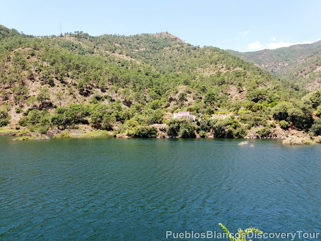
From here we have a good view of the reservoir.


To the right of the lake an isolated Finca.

After the winter rains the track is rather washed out

and it feels like we are walking in a dried-out riverbed.


The reservoir looked rather full this time of year.


A beautiful lizard sunbathing on a rock.

You can call this a twin pine tree or maybe a triplet!

After 1,5 km we have reached the waters edge.

Near the shore we find a pomegranate tree in blossom,

and a fig tree standing next to it.

Carefully we venture on a very narrow path,
towards the left along the hill.

Deep down the water edge!

Thereafter we have to cross a dried out brook.

and we had to climb up a little hill to reach a proper footpath again.


We find ourselves surrounded by lush vegetation.


Carefully we walked on along the shores narrow footpath.


Mediterranean Dwarf palm


The path winds itself through some rocks.


Between the rocks and in crevices you can find Succulents and Lichens.


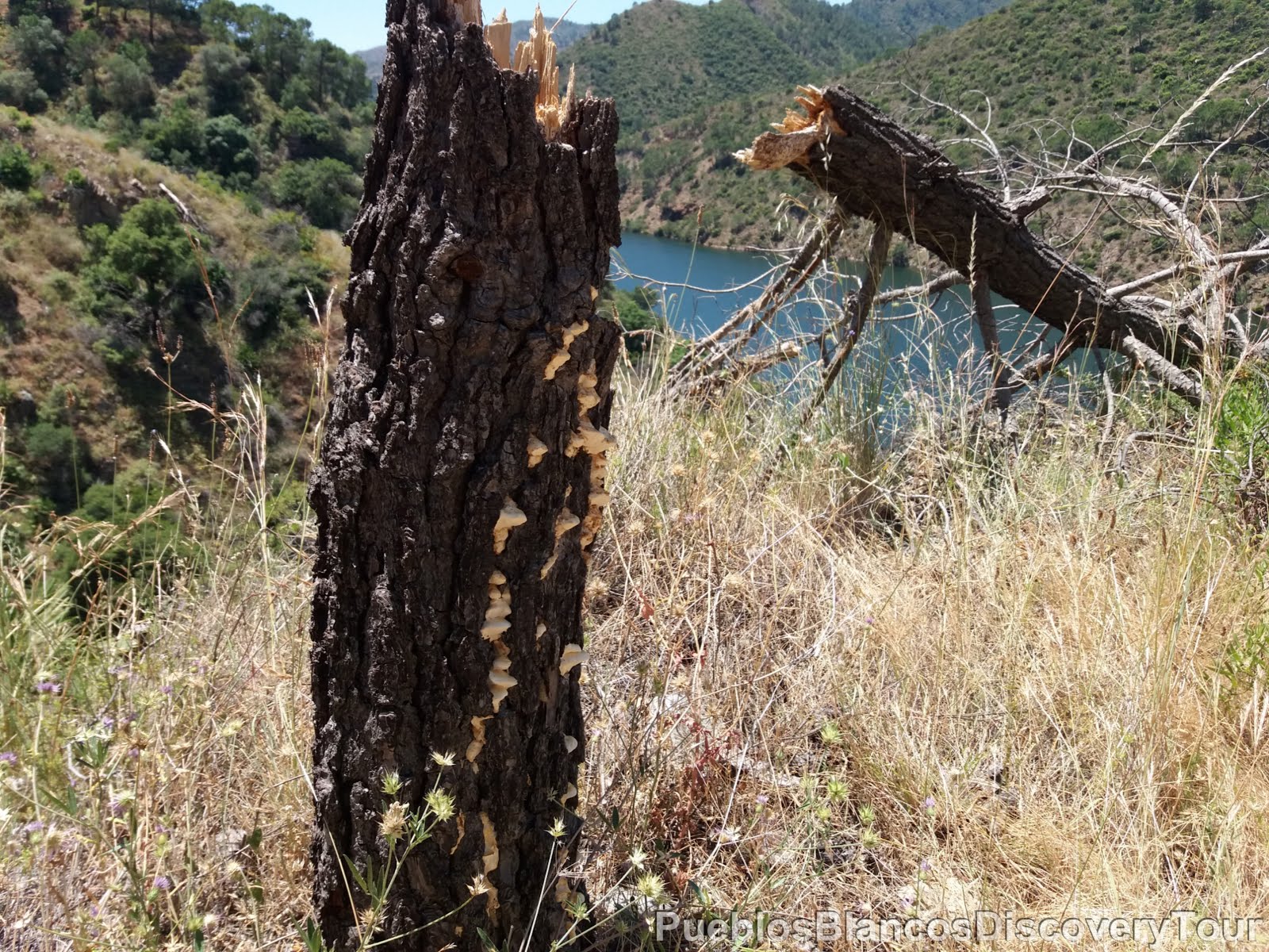
Some old trees still have life in them.
The conditions are harsh on this rugged steep terrain.


A sign indicates the danger of falling into empty space!

But the paint marks tell us, that we find ourselves on the right track.


With care, we carry on.


We reach the waters edge

and we are happy

to be able to refresh ourselves.

This location makes a good picnic spot.

A view across the lake towards the west.


From here on the path widens,

and we followed it uphill through a pine forest.


A view along the lake towards the south.

Amidst the dry grass, dainty little lilac flowers.

Onward and upwards.


The panoramic views are magnificent.

The steep hills surrounding the lake are covered with Mediterranean forest.
(Aleppo pines, various Oak trees, great variety of herbal shrubs and the
Holy Chestnut tree "Castaño Santo" can be found here).

Untamed nature!


A lonely cork oak tree (Alcornoque), with its bark removed.

The environment and time took hold of this pine tree.

A ravine leading down towards the lake covered with pink oleanders.

We cross over a dried out stream.


A view west towards the top end of the reservoir.

And up we go!


High up, a glimpse of the "Sierra Blanca",

As we turned a corner

and looked along the path,

there was a horse standing in the middle of it.

We find the poor horse tied up on the pathway with barely anything to eat, nor any drinking water in sight!

We very much hoped, that the owner had not forgotten it.

Reluctantly we leave the poor horse behind.

Near the track a thistle bush (Cardo) with large yellow flowers


Below us the crystal turquoise lake and in the back round the
Sierra Bermeja (Crimson mountains) .

A view towards the bottom end of the lake and towards the coast.

Our path meets up with a road leading down to the lake.

We follow this road up and towards the main road Marbella to Istán A-7176.

The sign tells us that it is 2,1 km to the village from here and so far we covered 2,7 km.

It is 166 meters down to the lake "Lago de la Conception".


High up in front of us the white lime stone rock of the Sierra Blanca

and we reach the the main road of Marbella - Istán.

This sign tells us it is 1514 meters to the lake from here
and the trail of the Hermitage "Camino de la Ermita" starts from here.


The viewpoint Mirador La Ermita de Istán I

From here it is 1,2 km leisurely walk back to the village.
Map of the complete hike
How to get to Istán

Related blog: The walk from "Ermita de San Miguel",
Nacimiento del Rio Molinos and El Coto
The hike from Istán up to La Concha

Prologue:
The village of Istán is located just a steppingstone away from Marbella, in the Sierra de las Nieves nature area. It is a small picturesque village nestling in a lush valley overlooking the Reservoir of La Concepcíon and in the foothills of the Sierra Blanca mountains.
The village of Istán is located just a steppingstone away from Marbella, in the Sierra de las Nieves nature area. It is a small picturesque village nestling in a lush valley overlooking the Reservoir of La Concepcíon and in the foothills of the Sierra Blanca mountains.
La Concepcíon is also known as the Rio Verde Reservoir, it was built in 1971 and it supplies the 450 000 inhabitants of the Costa del Sol with drinking water.
La Concepcíon Reservoir
Volume: 56hm3
Surface Area: 214 ha
Altitude above sea level: 106,55 meter
Height from riverbed: 89,55 meters - 70 meters

At the start of the walk you find a helpful information board.

Camino de la Cuesta PR-A 137
This is an enjoyable if somewhat demanding walk because of the steep climb from the reservoir to "La Ermita de San Miguel" (St. Michael's Chapel), but the impressive views undoubtedly make it worthwhile.
The route takes you from the dirt track of "la Cuesta" (the Hill) to the tail end of the reservoir, an inviting place to stop and enjoy the surrounding views. From this point onward, the path crosses a brook and runs along a small path surrounded by Mediterranean vegetation, narrowing in places rather like a long balcony overlooking the reservoir. After this stretch, take the dirt track leading to the road joining the coast with Istàn. Cross the road, taking the path leading to Ermita de San Miguel. After exploring the recreational area, a nice place for a short rest, the path takes another dirt track leading to the Hotel Altos de Istán at the end of the walk. To reach the village we recommend taking the "Paraje del Coto" route, a pleasant walk accompanied by the sound of water.
Information taken from the board.

Directions:
- To reach the mountain village of Istán, coming from Marbella in direction Cádiz on the A-7, taking the exit immediately after the tunnel right onto the road A-7176 to Istán
- The journey takes you about 30 minutes.
- Is a circular route of 4,8 km
- It takes about 2h 20 minutes, if you walk steadily and without a stop for picnic.

A Tourist booth in Calle Marbella stands at the entrance of the village. A helpful attendant will give you any information about the village and the various hiking trails in this area.
As the sign reads Istán is best explored on foot.

A view alongside the village and towards the hiking trail which leads to the lake.

At the end of Calle de Marbella we arrive at the church square.

There we turn into Calle Rio to the left of the Iglesia San Miguel.

We walk along the narrow alleyway

which leads us to the actual starting point of the trail.
Sendero Camino de la Cuesta PR-A 137

Looking across the vegetable fields, we get the first glimpse of the reservoir.

We follow the lane out of the village and gently downhill.


As we look across the old village wall we can see the "Sierra Blanca".

Called the White mountains, because the white lime stone rock is exposed, through lack of vegetation. Its highest points are;
Pico del Lastonar (1275 m), Pico de la Concha (the Shell) (1270m)

A large Carob tree (Algarrobo) next to the road.


The dark brown nut like shell of the carob tree.

After about 200 meters the concrete road gives way to a gravel path.

Behind us the village of Istán and the Sierra Blanca.

Paint marks on a rock indicate that you are on the right path.

The deep blue lake in front of us.

From the end of spring, you are able to see pink oleander bushes everywhere, near waterways and in ravines.
 |
| Oleander, Adelfa (Nerium oleander) |

The hillsides are covered with yellow blooming shrubs.
 |
| Yellow rock rose, Cistus, Cistaceae, (Halimium atriplicifolium) |

In springtime many wildflowers, as well as orchids, can be seen here.


The path starts to get steeper now.


From here we have a good view of the reservoir.


To the right of the lake an isolated Finca.

After the winter rains the track is rather washed out

and it feels like we are walking in a dried-out riverbed.


The reservoir looked rather full this time of year.
La Concepcíon Reservoir
Volume: 56hm3
Surface Area: 214 ha
Altitude above sea level: 106,55 meter
Height from riverbed: 89,55 meters - 70 meters


A beautiful lizard sunbathing on a rock.

You can call this a twin pine tree or maybe a triplet!

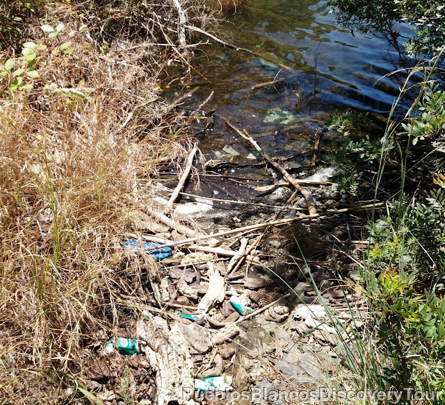
After 1,5 km we have reached the waters edge.

Unfortunately some people always have to leave their rubbish behind.

Near the shore we find a pomegranate tree in blossom,

and a fig tree standing next to it.

Carefully we venture on a very narrow path,
towards the left along the hill.

Deep down the water edge!

Thereafter we have to cross a dried out brook.

and we had to climb up a little hill to reach a proper footpath again.


A view across the lake and back from whence we came.


We find ourselves surrounded by lush vegetation.


Carefully we walked on along the shores narrow footpath.

A lovely old tree as it clings to the water edge.


Mediterranean Dwarf palm
 |
| Mediterranean Dwarf palm, Palmera enana (Chamaerops humilis) |
Also called European Fan palm is a shrub like cluster palm and the northernmost naturally occurring palm in the world and the only native one to the Iberian peninsula and the Balearic. It is a very hardy slow growing palm (2-5m), drought tolerant and can withstand cold temperatures (up to -12ºC of the high elevations of the Sierras of Southern Spain and the Atlas mountains/Morocco), but does prefers hot summers.


The path winds itself through some rocks.


Some old trees still have life in them.
The conditions are harsh on this rugged steep terrain.


A sign indicates the danger of falling into empty space!
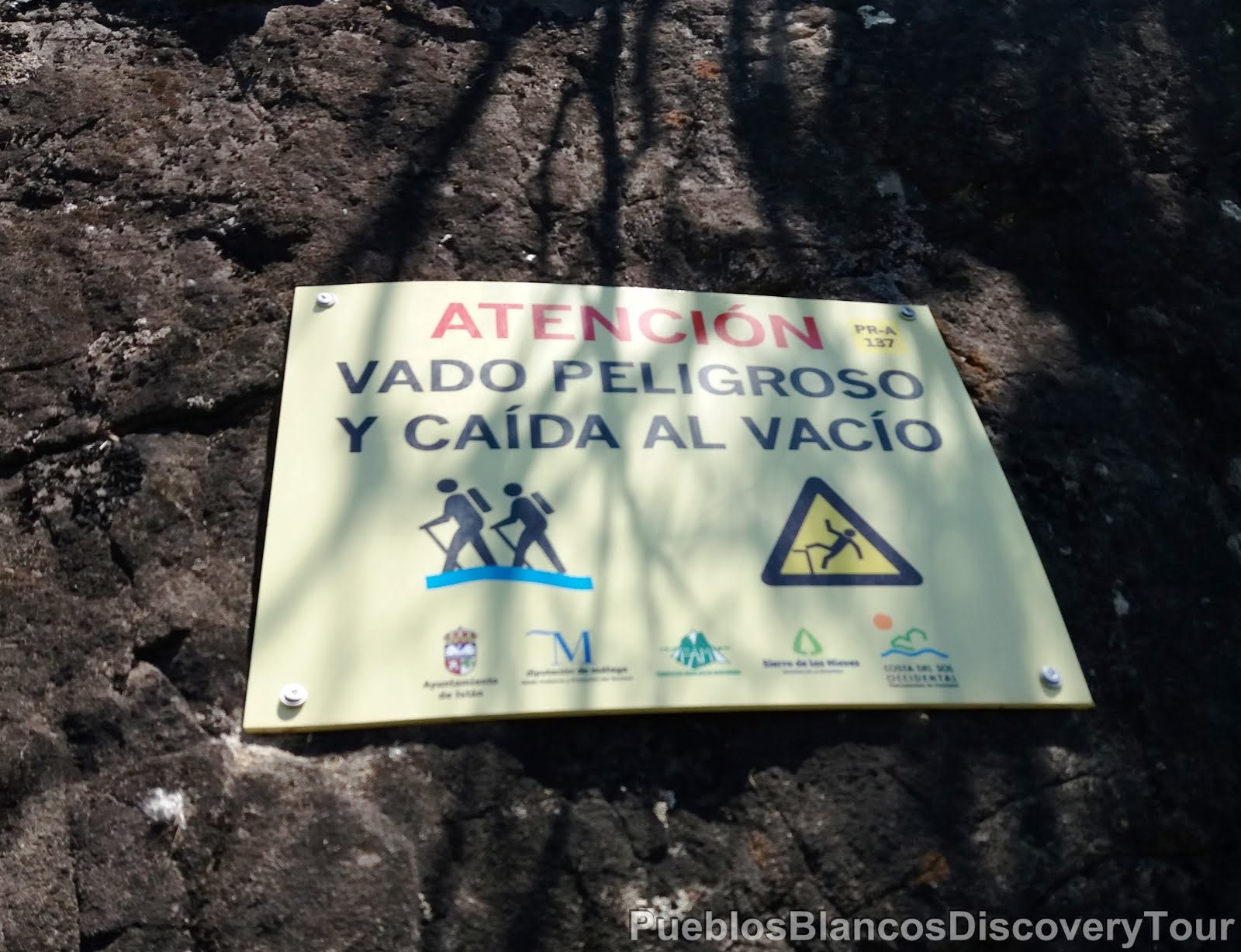
But the paint marks tell us, that we find ourselves on the right track.


With care, we carry on.


We reach the waters edge

and we are happy

to be able to refresh ourselves.

This location makes a good picnic spot.

A view across the lake towards the west.


From here on the path widens,

and we followed it uphill through a pine forest.


A view along the lake towards the south.

Amidst the dry grass, dainty little lilac flowers.

Onward and upwards.


The panoramic views are magnificent.

The steep hills surrounding the lake are covered with Mediterranean forest.
(Aleppo pines, various Oak trees, great variety of herbal shrubs and the
Holy Chestnut tree "Castaño Santo" can be found here).

Untamed nature!


A lonely cork oak tree (Alcornoque), with its bark removed.

The environment and time took hold of this pine tree.
A ravine leading down towards the lake covered with pink oleanders.

We cross over a dried out stream.


A view west towards the top end of the reservoir.

And up we go!


High up, a glimpse of the "Sierra Blanca",

As we turned a corner

and looked along the path,

there was a horse standing in the middle of it.

We find the poor horse tied up on the pathway with barely anything to eat, nor any drinking water in sight!

We very much hoped, that the owner had not forgotten it.

Reluctantly we leave the poor horse behind.

Near the track a thistle bush (Cardo) with large yellow flowers


Below us the crystal turquoise lake and in the back round the
Sierra Bermeja (Crimson mountains) .

A view towards the bottom end of the lake and towards the coast.

Our path meets up with a road leading down to the lake.

We follow this road up and towards the main road Marbella to Istán A-7176.

The sign tells us that it is 2,1 km to the village from here and so far we covered 2,7 km.

It is 166 meters down to the lake "Lago de la Conception".

But we follow the road up

which takes us further away from the lake.


High up in front of us the white lime stone rock of the Sierra Blanca

and we reach the the main road of Marbella - Istán.

This sign tells us it is 1514 meters to the lake from here
and the trail of the Hermitage "Camino de la Ermita" starts from here.

We crossed the main road and followed the steep path leading towards the
St. Michael's chapel "Ermita de San Miguel"

You can read more about the remaining part of this trail which leads us back to our starting point, in our next post. The walk from the St. Michael's chapel to Istán (Sendero Ermita de San Miguel), via the source of the river Molinos (Naciento del Rio Molinos) and the walkway through a botanical garden (El Coto de Istán).

You will find various picnic tables and benches set on the hillside next to the chapel overlooking the Lago de la Concepción.


The viewpoint Mirador La Ermita de Istán I

From here it is 1,2 km leisurely walk back to the village.
Map of the complete hike
 |
| Wikiloc: Istán, Camino de la Cuesta |

Related blog: The walk from "Ermita de San Miguel",
Nacimiento del Rio Molinos and El Coto
The hike from Istán up to La Concha
No comments:
Post a Comment