The Walk to the top of "El Hacho"
amid the blooming Peonies.
amid the blooming Peonies.
.jpg)
Prologue:
Springtime, from the end February to June is maybe the best time to take a hike to the summit of "Hacho" near the village of Gaucín, Serranía de Ronda.
The wildflowers you are able to see are just amazing. The most stunning, were wild Peonies which I have never seen in the wild before, and they were everywhere. You will also see many types of wild orchid. The 360º panoramic views are stunning. To the west Los Alcornocales Nature reserve, to the north the Serrania de Ronda, to the east Sierra Bermeja and Sierra Crestellina and to the south the Campo de Gibraltar, and on clear days, the north African coast and the Rock of Gibraltar.
The wildflowers you are able to see are just amazing. The most stunning, were wild Peonies which I have never seen in the wild before, and they were everywhere. You will also see many types of wild orchid. The 360º panoramic views are stunning. To the west Los Alcornocales Nature reserve, to the north the Serrania de Ronda, to the east Sierra Bermeja and Sierra Crestellina and to the south the Campo de Gibraltar, and on clear days, the north African coast and the Rock of Gibraltar.


- From Marbella on the Autopista A-7 is about 67 km to the village of Gaucín and it takes about 1 hour, including stops at viewpoints.
- Take exit on toll road by Manilva direction Casares A-377.
- When you turn of the Toll road you will see a big quarry to the right, the road to Casares/Gaucín leads above it and alongside a windmill park.
- It is a very scenic drive and you feel in harmony with nature, grazing Andalusian cows, wandering goats and horses in a field can be seen along the way, as well as birds of prey like the Griffon vulture which glide through the air above you.
.jpg) |
| Sierra Crestellina |
- Reaching the village Gaucin, you turn left at the crossroad and head for the petrol station. At the roundabout you take the 3rd turning, which takes you behind the petrol station. It is here where we parked our car.

- The Hike starts in the street Camino del Montoro which is just behind the petrol station.
- It is a moderate to high 6,1 km circular route and you will cover an elevation difference of 470 meters.
- The summit of Sierra del Hacho is 1011 meters above sea level.
An information board give you a brief explanation of the route.

"Hacho"
An elevated site near the coast from which the sea is clearly visible and where signal fires were once used.
Starting from Gaucín, the footpath rises to the "Hinojales" mountain pass.
The climb up to the mountain pass offers impressive views over the Genal Valley, a mere foretaste of what is to come during the rest of the walk. A restored lime kiln lies along the way, one of many, which in the past were as abundant as they were necessary. After passing the imposing face of the Tajo Bermejo rock, continue uphill until you reach the summit of the Sierra del Hacho which at slightly more than 1000 meters above sea level offers extraordinary views of the Campo de Gibraltar area. On a clear day, El Hacho's twin can be seen on the other side of the Mediterranean on African soil, El Hacho de Ceuta.
From the summit, with the Spanish and African coasts seemingly within your grasp, the Rock of Gibraltar rises strikingly before you.
Leaving the summit behind, the path travels downhill, gradually revealing the Sierra de Grazalema Nature Park and the village of Cortez de la Frontera perched on the slope of the Sierra de los Pinos, overlooking the impressive Guadiaro Valley.
The walk back along the Hinojales mountain pass seems easy in the shade of the magnificent Mediterranean woodland. From the mountain pass your starting and finishing point Gaucìn, lies at your feet, where the Castillo del Águila fortress rises like a perpetual bridge between the sea and the mountains.
Information taken from the board.

50 meters from the information board a sign points you towards a narrow footpath uphill.


We find ourselves surrounded by wildflowers.


We pass a small forest of eucalyptus trees.


The summit of "Hacho" is ahead of us.


Grazing sheep in an almond grove.


Looking back towards Gaucín and the Castillo del Águilla.

White and pink rockroses (Cistus) are standing next to each other.


A large bush of the Broom (Genista) familie.


 |
| White Rock-rose, Cistus (Cistaceae) |
 |
| Dandelion, Diente de león (Taraxacum officinal) |


 |
| Sage leaved Rock-rose, Cistus (Cistaceae) |

A glimpse of the summit.

An orchid just coming into bloom.
 |
| Anacamptis collina |
The view towards Gaucín and the
Serranía de Ronda and the Sierra de las Nieves.
Serranía de Ronda and the Sierra de las Nieves.

Admiring the countryside and the scenic views.

This view is towards the north/east and the Los Reales de Sierra Bermeja

and also the Sierra de Crestellina.


 |
| Lavender, Lavandula |

In full view, the village of Gaucín with its Eagle castle (Castillo del Águila)


Blue markings on a rock or a tree tell you that you are on the right track.


A glimpse through the branches of a magnificent cork oak tree.

The higher we walk the more rockier the path.


After 1,2 km and about 150 meters above the village we reached a clearing, Puerto del Hacho.

From here you have a terrific panoramic view.

To the west, overlooking Mediterranean forests with their great variety of trees and shrubs,
the Alcornocales Nature reserve and the Cadíz mountains.
Facing left of us,

the summit of Hacho looms above.

From the clearing we turn left and we walk along to the west side of Hacho.

The pole tells you that this part of the route is a stretch of
GR-141 Gran Senda de Serranía de Ronda.

The trail leads you through a cork oak forest.

We were astonished to find wild Peonies growing everywhere.

|
| Peony, Peonía (Paeoniaceae) |
The Wild Peony is a 0,5-1,5 meter herbaceous perennial plant with large red flowers, which bloom from late spring to early summer (April to June). They prefer acid and neutral soils, full light in semi shade places, and also tolerates dry periods.
Wild Peonies can be found throughout the Iberian peninsula and in many Mediterranean countries. The root of the Peony contains medicinal properties and its usage dates back to the 4th century BC. Traditionally used to combat seizures, headaches, dizziness etc....


Throughout our hike we come across great variety of trees and shrubs like,
Cork oak (Alcornoque), Holm oak (Encina Meridional), Wild olive tree (Acebuche), Carob tree (Algarrobo) and many more......


Following this route it is 4,7 km up to the top and back to Gaucín.

So far we have covered 1,4 km
and it is 6,8 km to the village of Colmenar-Estacion de Gaucín.

Calera de los Hinojales (Lime kiln)


The Furnace "Calera"
The furnace was constructed by means of excavating in the hillside of the mountain a cylindrical shaped pit about 2-3 meters in diameter and 3-4 meters deep. It was usually internally covered with a wall made of granite stones, the layer closest to the surface, called "the parapet". In the lowest part of the pit the cylinder reduces its diameter in such such a way, that inside the pit around it, a small stone bench or "poyal" was used as a base to put the stones to be baked. This small stone bench is 70 cm high and formed the walls to the furnace cauldron or "calderula" where the firewood would be burned. A ramp is excavated by one side of the pit from the surface to the base, forming "the mouth" of the furnace. This zone is called "the server" and was where the lime burner would place the firewood to be burned.
Information taken from board.

The Quicklime
is made by the calcification of the limestone to 1000 Cº for a period of 20 to 30 hours. The quicklime is very caustic and has a great affinity with water and when they come into contact, it transforms into calcium hydroxide or "slaked lime". The use of the quicklime for the manufacture of mortar has been essential to the building of solid constructions.
Mortar is obtained by mixing slaked lime with sand and water, when the mortar is formed, the quicklime hardens, recovering the CO2 in the atmosphere to transform again into calcium carbonate, recovering its original hardness whiteness and impermeability.
The slaked lime dissolved into water is the "milk of lime" being traditionally used to whitewash the walls of the houses. This film has a marked white colour and is waterproof and is widely used in Andalucía.
The milk of lime is also used to disinfect the trees, to prevent the putrefaction of the stagnant water....
Information taken from board.

We take in the views before we head uphill.

In this direction we look north towards Serranía de Ronda.

Towards the west and across the river valley of Rio Guadiaro,

and on the horizon the mountain rage of Sierra de Libar
with the white village of Cortez de la Frontera.

To the south and towards the Campo de Gibraltar.
The village of Colmenar, Estación de Gaucín is below us.

From now onward the path is quite steep and rocky in places.


This huge rock sticks out like a thumb!

Some man-made steps assist us on our way.


Even this scraggy old tree comes alive in springtime.


We have reached the high plateau of Hacho.

and we are heading towards the north summit.

Even at an altitude of around 1000 meters above sea level we find wild Peonies between the rocks.

At this point 360º panoramic views are just amazing.


To the east overlooking the river valley of Rio Genal, and the view towards Sierra Crestellina and the Cacares/Manilva coastline.

Gaucín from a birds eye perspective.

Towards the west the river valley of Rio Guadiaro and the Pueblo Blanco of
Cortez de la Frontera in the foothills of the mountain range Macizo de Libar.

It is quite unique to find a summit logbook between the rocks in this part of the world.

Nearby we found an ideal location for a picnic.
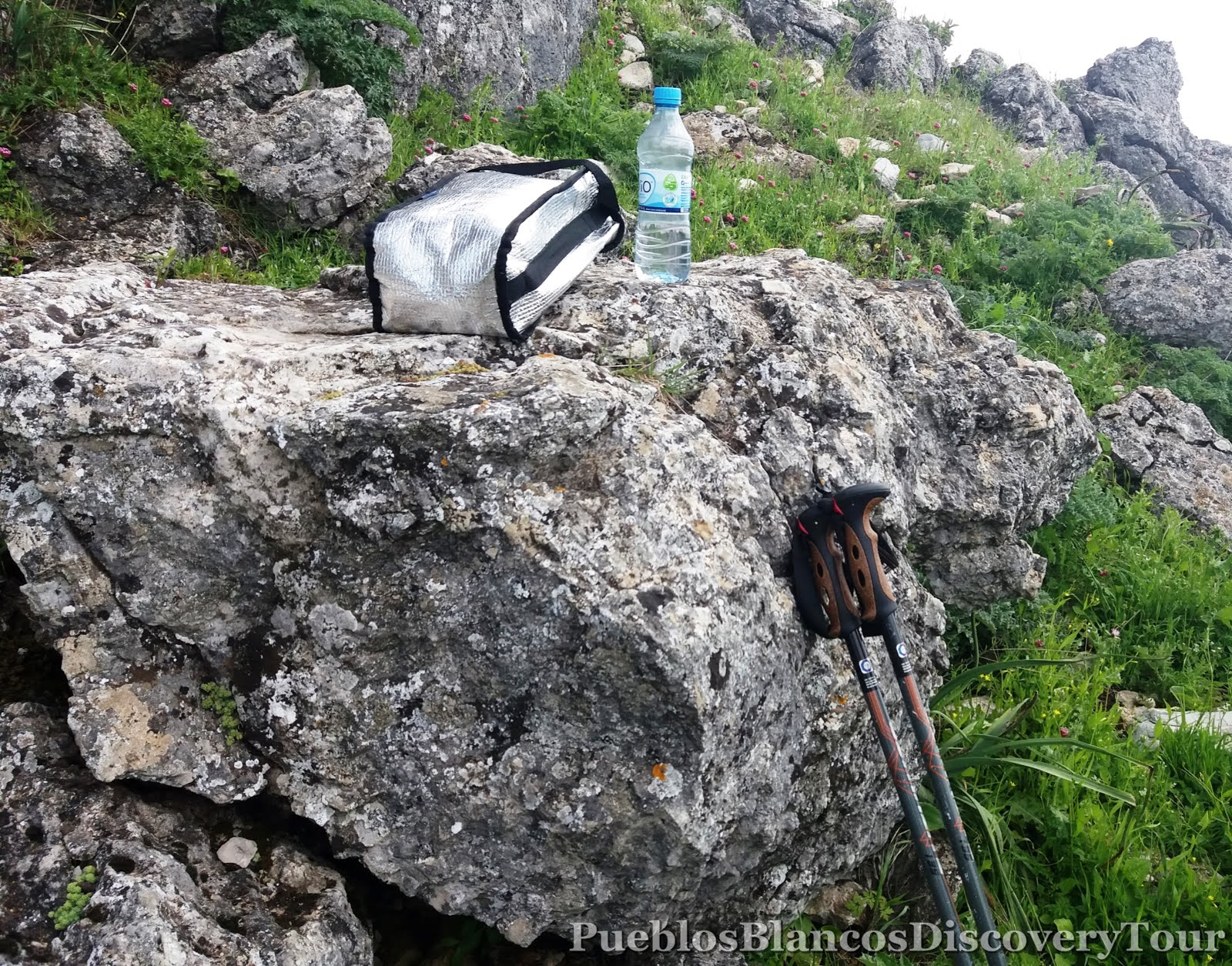

After refreshments we carry on along the plateau.


The view towards the north summit.
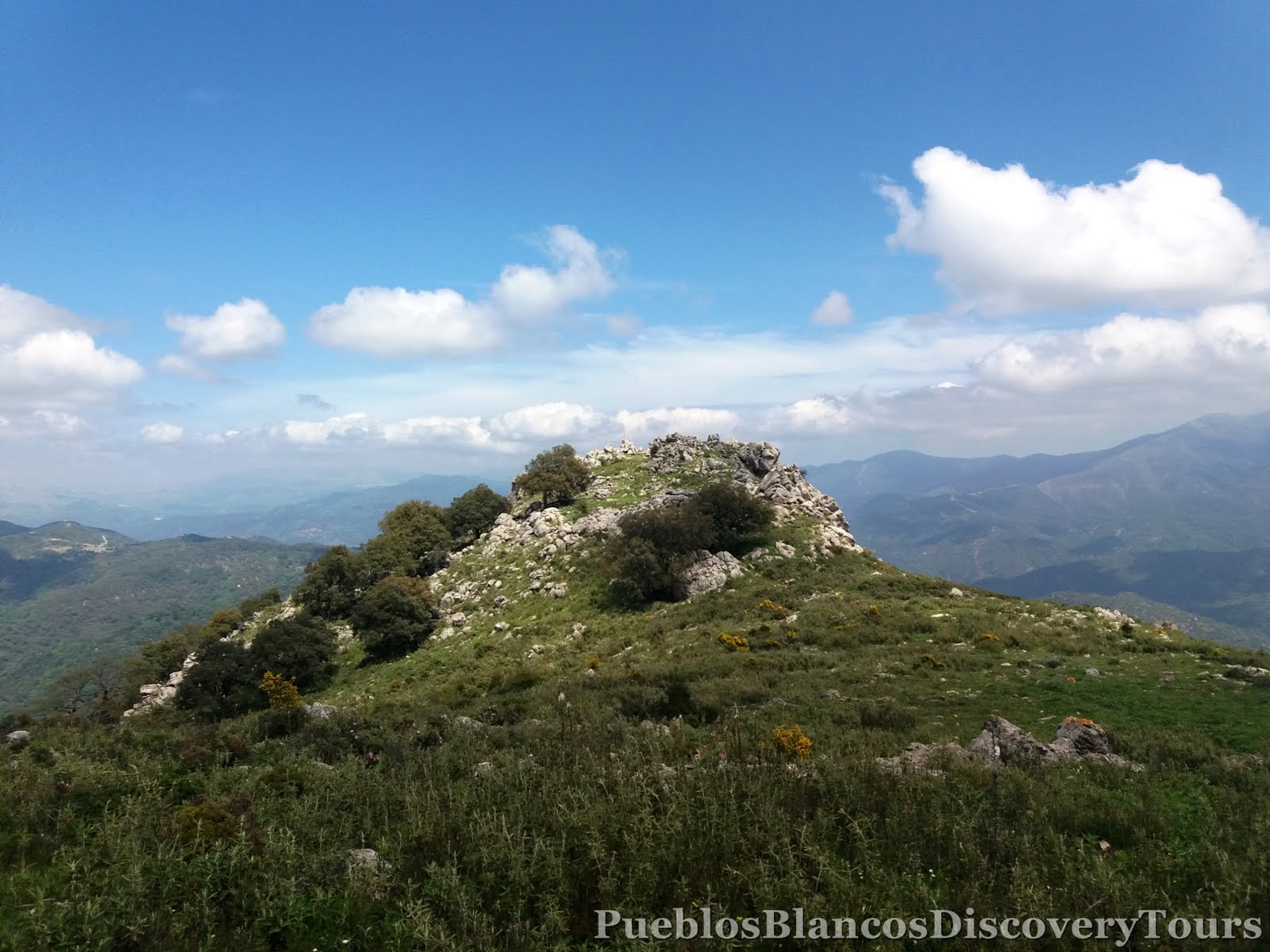
Now we are heading south.

The cemented pole indicates that we have reached the highest point of Hacho.


1011 meters above sea-level.

A terrific lookout point.

Unfortunately it was hazy, otherwise we would've seen
the Rock of Gibraltar and the North African coast to the south.

To the north we can make out the village of Genalguacil and beyond the Sierra de las Nieves.
In the foreground the Sierra Bermejas and Gaucín.


We have reached the most southern point of the summit plateau.


We followed the track down towards the south/west.


We notice many trees covered with lichen and moss.

They seem to thrive with the moist sea breezes coming from the west.


A neglected ancient furnace.


We ventured forward carefully as the path was not well marked.


With relief we came across a track post.

The view up the mountain ridge and the thumb rock.

The Sierra de Benadalid, Benalauría and Algatocín form the mountain ridge which separates the 2 river valleys, the Valle de Genal from the Valle de Guadiaro.


Amazing to see how some trees grow in these rocky arid conditions.


The path leads us onto the other side of the fence.

The view north and towards the summit.


Another furnace.

The trail lead us through an ancient cork oak forest.

Every 9-12 years the cork is harvested.


We cross a small stream and along a revine.


What a magnificent huge old tree.

How many passers by must have seen it through the years.

2.6 km to the point from whence we started.


An ancient chestnut tree.


A large mushroom makes its way through the stoney ground.


So happy to find ourselves on the right path.

A welcome sight,
Water!

As the ground levelled out the trail was easier to follow.

We pass again through a fence.

High above us the summit of "Hacho".

From now it is only 1.4 km back to the village.

At this point, we follow part of the route (Gran Senda Serranía de Ronda GR 141), which is part of the hiking trail throughout the Ronda region.

This section is from the village of Gaucín to Colmenar Estacion de Gaucín.

Some more wildflowers we encountered on our way. |
| Yellow bee-orchid, Ophrys lutea |


Map of the hike
 |
| Wikiloc: Gaucín, Sendero del Hacho |

Related Blog: Gaucín and the Eagle castle "Castillo del Águila"
No comments:
Post a Comment