A Walk near the source of the river Guadalhorce,
Fuente de Los Cien Caños, Nacimiento de Río Guadalhorce

Prologue:
Having visited the mouth of the Guadalhorce river, which is a nature reserve and a bird sanctuary many times, we wanted to see where this mighty river originates from. So on a beautiful spring day we took a drive to the source of the river Guadalhorce, which you will find approx.:
60 km north/east of Málaga city.
The source lays in the mountains of Sierra de San Jorge near the village of Villanueva del Trambuco, and after 166 kms it flows into the Mediterranean sea by Málaga city. The drive takes you north and away from the coast in the direction Antequera/Granada. At the municipality of Villanueva del Trambuco we turn away from the main road and drive through olive groves for a few kms, until we reach the foothills of the mountains of Sierra de San Jorge, at "Fuente de Los Cien Caños" the Fountain of 100 Spouts, There you find a large car park and various picnic tables where you can enjoy the unique and beautiful surroundings.

The village of Villanueva del Trabuco is situated north/east of Málaga Province.

In the village we follow the way-sign towards "Fuente de Los Cien Caños".
From there we drive eastwards, towards the mountains.

Directions:
- Follow the motorway A-7 from Málaga in direction north to Antequera/Granada A-45 and onto A-92M. From Torremolines it takes approx. 45 min 69 km.
- Take exit 16 to Villanueva de Rosario MA-224 and MA-7203 onto the village of Villanueva del Trambuco 7 min.
- In the village follow the road sign "Fuente de los Cien Caños" MA-4100 for about 13 min. 8 km.
- Just past the fountain you find a large carpark with adjoining picnic tables.

| >> Wikiloc: The trail of the 100 Caños |
The Hike: "Sendero de los 100 Caños" was a leisurely 4,8 km loop walk from the picnic ground come car park by "Fuente de los Cien Caños Natural Monument".
Note: Depending on recent rainfall some part of the trail along the stream might be difficult to pass.

Having reached our destination, we headed to the fountain with 100 spouts.


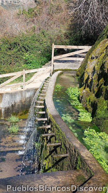
The fountain of the 100 spouts and the source of the longest river in Málaga province the Guadalhorce (Fuente de los Cien Caños-Nacimiento del Rio Guadalhorce), was declared a natural monument in December 2011, it covers an area of 8,25 ha.

It is fascinating to see the water gushing out of the limestone rock and captured in troughs, finally flowing out of the many spouts which gave this fountain the name of the 100 spouts.


This place makes you realise how precious water is, especially after some years of hardly any rain.


The information board gives you an inside about the history of the river and what role it played for the people of this area.

%20-%20Copy.jpg)
Back at the picnic ground come car park, we read up on the grand walk-way of the river "Gran Senda del Guadalhorce".

The information board also explains to you what you can experience along the riverside walk.

On the right side of the park near the stream you find a way sign.
The village of Villanueva de Trambuco, from whence we came, is 7,3 km from here.

The picnic ground is an ideal place for the whole family all year round.

Weeping willows were planted throughout the grounds to give visitors welcome shade in the hot summer months.

Today we follow the trail of the "100 Caños" which is a circular route of 4,8 km.

From the fountain the water runs in trickles or sometimes as a torrent,
depending on the latest rainfall, over rocks until it finds the course of the stream.

Near the stream, an information board is dedicated to the countryside the river has carved through until it flows into the Mediterranean see.


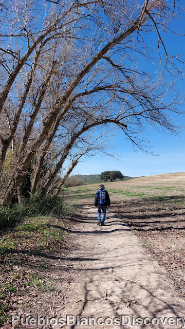
We follow a small footpath downwards along side the stream.

Near the waters edge the vegetation is lush.

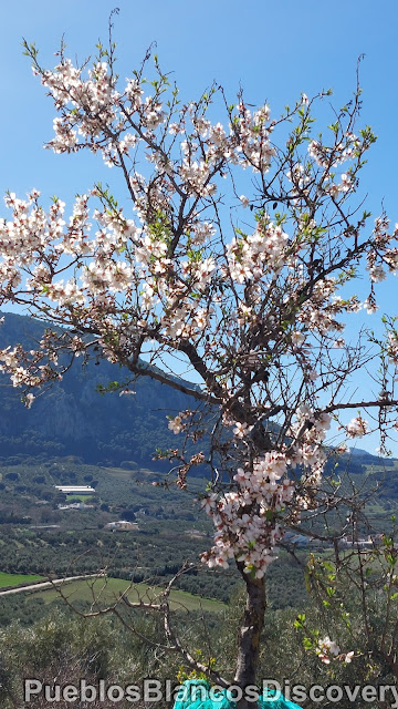
From the middle of January until the end of February Almond trees are in bloom everywhere.

A view north/east.

Rosemary bushes grow at the way side.

This time of year the Rosemary is in full bloom.

Hardly to imagine that this small brook is the start of the longest river in the
Málaga Province.

Rio Guadalhorce!

About 1 km from the park we follow a way sign towards the left.

Now we walk on the right side, down stream.

A view across an olive grove towards the mountains.


The olive trees stand like soldiers in a neat row.


A view across the brook.

It is very relaxing to hear the ripple of the water.


A tunnel has formed through the vegetation.

Leisurely we stroll along side the stream.

The mountains form a wonderful backdrop.

A huge oak tree takes centre stage in a field.


A view back from whence we came.

There are some very large trees of all types along the way.

After heavy rains you might have difficulty crossing over the stream, hence the sign.


In the distance the limestone mountains.

On the other side of the stream lays a Mill which is also a small country lodge.

To avoid getting wet feet we did not venture across the stream today.


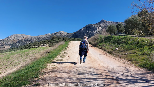
A view towards the mountains of Sierra de San Jorge.

The actual footpath to the village V. d. Trambuco carries on the other site the brook,
but we followed a gravel road up hill and walked towards the mountains.

Further up we see a small settlement.

The site of the 100 Caños is approx. 2 km back from here.

So peaceful, and such stunning scenery wherever you look.

Olive trees as far as the eye can see, in the distance "El Torcal" Nature Park near Antequera.
It is early Spring, and the Almond blossom brightens up the countryside.
What a lovely marigold plant!

Steadily we walk uphill towards the mountain.
At the road junction we turn left,

and down in the valley, the stream we have just walked beside.


We viewed the mill from the other side of the stream earlier on.
You can visit the mill, which is one of the Casa Rural chain of country homes, which take in guests.


On the way we passed a farm, unfortunately I couldn't get a picture of a group of chickens as they run across the road, but the sheep were inquisitive!

Here we turn left again, this road leads back towards the Park.


From higher elevation the panoramic views are amazing.


Panoramic views south/west.


We take a shortcut towards the picnic ground.


We take a last look at the fountain of 100 Caños, before we set out on our return trip.


After the hike we appreciate the refreshing water.


A last photo before we set off on our trip home.

The Map of the Hike

| Click on link:>> Wikiloc: The trail of the 100 Caños |
How to get to Fuente de 100 Caños

No comments:
Post a Comment