"The Kings Path"

Prologue:
Caminito del Rey lays within the Desfiladero de los Gaitanes Nature Park in Málaga Province. This area is of outstanding beauty and a nature lover's paradise. It is a thrilling and very scenic walkway which we have visited on numerous occasions and every time it is a new experience.
Caminito del Rey lays within the Desfiladero de los Gaitanes Nature Park in Málaga Province. This area is of outstanding beauty and a nature lover's paradise. It is a thrilling and very scenic walkway which we have visited on numerous occasions and every time it is a new experience.

In March 2015 the King's Path "Caminito del Rey" was reopened to the general public again.
In April 2017 a private company took over the running and maintenance of the walkway.
You can book an entrance ticket online or obtain a ticket on the day at the North entrance of the Caminito del Rey at a cost of 10€ per person.
www.caminitodelrey.info Telf.: 902 787 325
Note: to wear appropriate shoes and take a bottle of water along.

The King's Path was build initially in 1901/05 as a supply route to help with the construction of the hydroelectric power plants of El Chorro.
 |
| Read more: History of the Caminito del Rey |
The King Alfonso XIII walked the path through the gorge as he visited the area in 1921 at the inauguration of the Conde de Guadalhorce dam. After that it was known as the Kings Path, "Caminito del Rey".
 Directions:


- Coming from Marbella, head inland towards Coin A-355 and onto Campillos A 357. Or from Málaga head inland in direction Cartama towards Campillos A-357.
- By Ardales you turn onto Ma-5403, the North entrance to the Caminito del Rey and Embalse Conde de Guadalhorce.
- The drive takes you roughly 1 hour.
- You can leave the car near the El Mirador Restaurant
- From the restaurant a stairway leads back to he main road. Turn left at the bottom and walk along until we reach the entrance tunnel to the Caminito del Rey.
- It is about 1,4 km, 20 minutes, walk to the entrance of the gorge and the Caminito del Rey.
- Another route is from near the dam Conde de Guadalhorce and the King's chair by the restaurant El Kiosko. 2,7 km.
- The total hike is about 7,7 km long.

The actual walk on the Caminito del Rey is 2,9 km on a well built, secure and well monitored pathway. Allow yourself 2,5 - 3 hours for the entire walk as the views are stunning and you want to stop to take in the breathtaking scenery.

A 200 m long tunnel which leads you towards the Caminito del Rey is midway between the restaurants El Mirador and El Kiosko.
Note: you are able to walk along the forest road leading up from the restaurant El Mirador and to the viewpoint Mirador de 3 Lagos.

After the sparsely lit tunnel you follow a forest road for 15 minutes before you reach the ticket office.

Throughout the Desfiladero de los Gaitanes Nature Reserve the vegetation is varied.
Aleppo pine, stone pine, holm oaks and eucalyptuses make the tree population, supplemented with shrubs, particularly junipers, dwarf fan palms, broom,
rock-roses and oleander bushes by riverbeds.

Natural forces have carved out bizarre rock formations. Actually they are tafoni, cave like formations, created when clay is compressed by big blocks of sandstone due to external factors like wind and water.

Many caves can be found in this area, some with human traces dating back to Neolithic times.

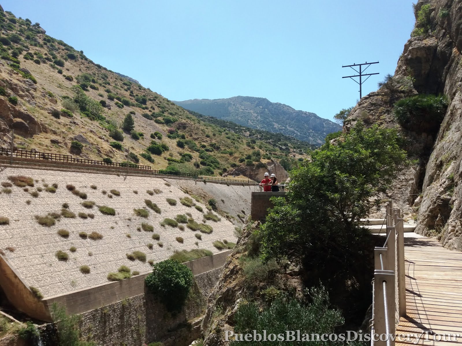
Deep down you see the Embalse de Gaitanejo.

At the ticket office we wait until small groups have gathered and everybody is ready to

receive safety instructions and the obligatory helmet from the helpful wardens.
There are only 50 people allowed on the path every 15 - 30 minutes.

There is an air of great excitement and expectation as we proceed.

We pass a Hydroelectric power station of Gaitanejo.

Looking across the river we noticed cave dwellings along the banks.

A last look back along the open valley and ahead of us the gorge.

With admiration and maybe apprehension, we walk on.

We prefer to take our time and enjoy every moment.

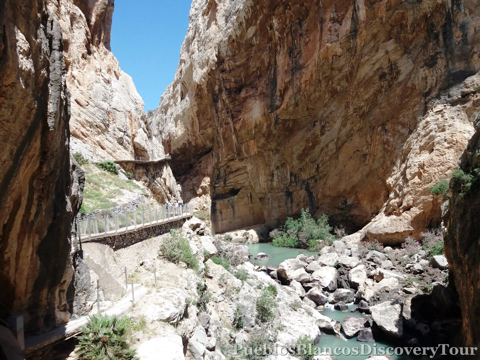
The Gaitanes Gorge is a canyon, carved out by the river Guatalhorce in the territory of Álora
.
It is about 3 km long, with at some points only 10 meters wide


It is breathtaking!!

We feel in awe of it.


We follow the pathway up, down and around corners.


The steep winding slope that stretches along a cement walkway and the so called Butter Stairs (Escalera de Mantequilla) due to its wavy shape, which was conserved during the refurbishment.

We are totally amazed at the engineering and craftsmanship it must have taken to create this path for our pleasure.

At times the track seems to hangs precariously to the rock-walls.

We are certainly pleased that the track is safe and sturdy.

Pigeons have made the sheer rock-face there home.

We walk down and towards the lagoon.

Below the walkway you can see the triangle cave of


How small we look in the face of nature.

Pigeons have made the sheer rock-face there home.

We walk down and towards the lagoon.

Below the walkway you can see the triangle cave of
El Soto dating from Neolithic times 5000 BC
A look up to where we just were.

How small we look in the face of nature.

A view along the lagoon and towards the Gaitanejo gorge.

The path leads you through a tunnel over a covered water canal.


Suddenly we find ourselves in the open again.
On the other side of the gorge you can see the
Málaga - Cordoba railway line.

Just at this time as we look across

a train appears from the tunnel.

a train appears from the tunnel.
 |
| Read more: History of the Malaga - Cordoba railway line |
The Málaga - Cordoba line was first constructed in 1860 and completed 1866.


Ahead of us we see an old bridge across the gorge.

This is the kings bridge (Puente del Rey), because
King Alfonso XIII walked over it.


A view along the valley of Valle de Hoyo.

A stunning panoramic view at this point.

As we look up we spotted birds of prey circling in the sky.

We were so lucky as we caught sight of


An information board explains to you the Fauna which can be found in this area.
Wild boar (Jabalí) forage in the undergrowth near the river, whilst Spanish Ibex (Cabras del Monte) roam the higher slopes, as well as many other animals.
Wild boar (Jabalí) forage in the undergrowth near the river, whilst Spanish Ibex (Cabras del Monte) roam the higher slopes, as well as many other animals.


A feeling of space and freedom is all pervading.

Deep down we can see the ruins of Finca de Hoyo.


In this area you can find many carob trees (Algarrobo)

The track leads you past a stream,

and a welcoming sight,
"Water"
to refresh our tired limbs.
"Water"
to refresh our tired limbs.

Also we found an ideal place

to rest and have a snack.

Refreshed, we walk on.

The sign telling us that we have reached halfway.

The path leads you through

and along side a water canal.


The view along the valley and the railway line.

Ahead of us the most dramatic area of the gorge.

I believe this rock formations is named

St Christopher's Niches

We approach the final stage of the walkway.


A very narrow part of the gorge

and a most exhilarating one.

A short stretch of the railway is touchable near before it disappears again into the mountain.

Ahead of us, another highlight of the walkway.


Step by step and lost for words we feel our way along the path.


We are approaching

the glass balcony.

This is certainly a most thrilling part of the gorge.

Across from us is the cathedral rock or St Christopher's Niches.


the hanging bridge.

The path winds along the rock-face

and with admiration we look at

the old walkway as it still hangs precariously

beneath us.


The view back from where we come.


In front of us the aqueduct and the hanging bridge.

This plaque is in commemoration of three young climbers who lost their lives in year 2000.


With apprehension and a feeling of sadness

we approach the final stage.

Just breath taking!!

The hanging footpath 105 m- high and 35 m long.

This part of the gorge is commonly known as
El Chorro.

The aqueduct bridge 35 m. long, transfers water
between two vertical walls of 300 m. in height.


The pathway follows the old one along a sheer rock-face.

A quick look back at the bridge

and then we carry on towards the railway tunnel.

The benches invite you to take a breather

and enjoy the view south along the Embalse

Another hurdle, and we have managed it.

The stairs take you over the railway tunnel.

Satisfied and humble to have completed this walk.


We passed the control point, and the last 2,1 km we walk on a service road to the village of El Chorro and the railway/bus station.

We were pleased with our achievement as we handed back our helmets.

The chapel Virgin la Medalla Milagrosa


Ahead of us and on the right we see the
El Chorro Hydroelectric Power station.

 |
| Read more:Embalse Tajo de la Encatanda |

High above the power station you are able to see a tower which is part of the higher reservoir Embalse Superior Tajo de la Encantada.


El Chorro train station forms part of the Málaga - Cordoba railway line and was of great importance for the village of El Chorro, which had been isolated before this line was build in 1865.

Near by you find a kiosk where you can get refreshments and can wait for the bus to take you back to your starting point.

A final look back towards at the Caminito del Rey

How to get to the North entrance
of the Caminito del Rey


No comments:
Post a Comment