Igualeja to Parauta on the Chestnut trail


 Directions:


At the entrance of the village you pass a sports ground.

After you cross a bridge by the Hotel El Nacimiento and turn left,


It is a natural beauty spot and well worth a closer look.


The course of water is guided through a deep channel in the village.


Igualeja has been built along the ravine on different levels.


We leave the village behind us.

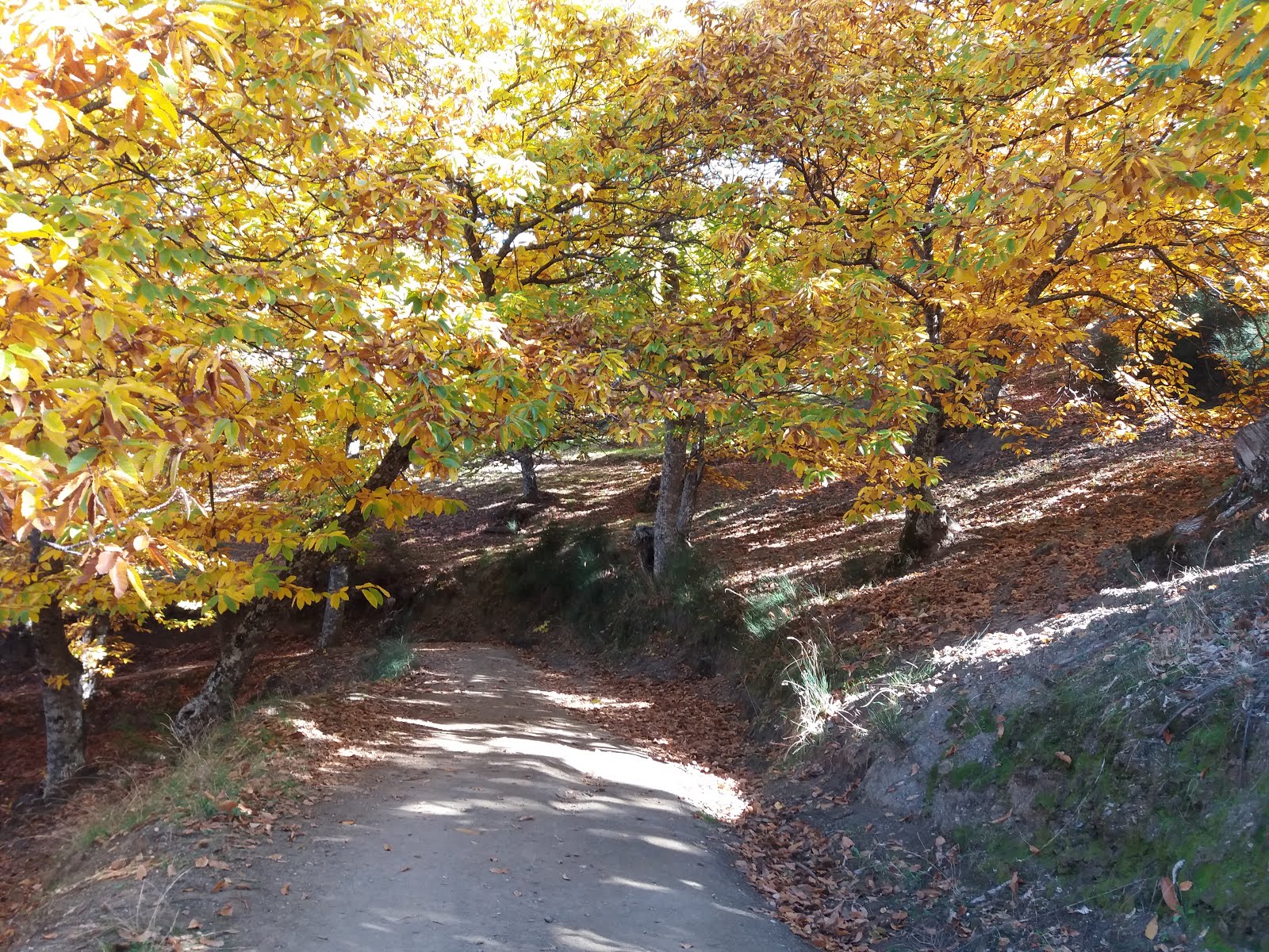
At first the track leads us uphill.


The path narrows.

We walk beside a fence.

As you look back you see the village Igualeja through the chestnut tree foliage.

All around us just chestnut trees.

All you can hear is the wind playing with the leaves.
It is just so peaceful.

Some of the trees are very very old.


We reach a fork in the road,

we turn towards the right and hope we have made the right choice.

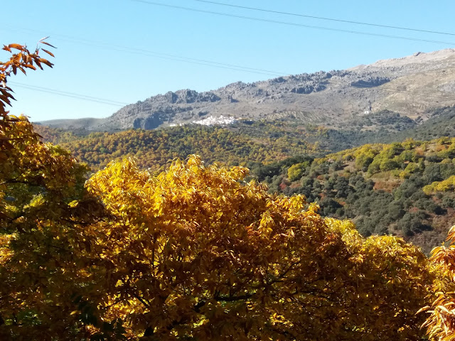
Ahead and slightly towards the left you see the village of Cartajima and behind the Limestone mountains of Sierra del Oreganal.

The walk now takes us steadily downwards.

The first road sign we come across!

A pile of stones indicate that you are on the right path.
This we find on our hikes in Andalucía very often!

From here we see the village of Cartajime more clearly.
In the background the Karst rock formation of "El Risco".

On the left you see giant power lines.


The chestnut trees (Castañas) thrive on the hilly slopes and acidic soils of the Serrania de Ronda.


Sometime you are happy to see any kind of man made road signs!


For a healthy chestnut forest, the trees are pruned regularly and the ground is kept free from unwanted plant undergrowth.

We have reached the lowest part of our route and the mule track joins with a concrete road on the other side of the stream.

From now on we climb uphill on a concrete track towards the village of Parauta.

The limestone rock is shaped by the wind and the rain, and caves are often formed.

This is typical for this area.

High above you are able to see the road we came from.


We come across some cork oak trees lining the road.

The bark (cork) has been removed recently.

It shows up the orange brown trunk.


We walk steadily uphill.

High above you are able to see the road which leads towards the villages of Cartajima, Júzcar, Faraján and Alpandeire.


The white dot in the distance that you see is the village of Cartajima and the limestone rock of "El Risco"


As we turned a corner the first houses of Paraute suddenly appeared.

From here we got a good view of the dramatic limestone mountains of
Sierra del Oreganal.


This sign talks about the villages Moorish past

and this one how olive oil is produced.

We found many intriguing nooks and crannies.


In Parauta we noticed most interesting looking mail boxes!

After the pleasant hike and a brief look around the village of Parauta we looked forward to finding a nice restaurant.


It served hearty, mountain dishes.
Just right for hungry travellers and for cold winter days.
A typical dish from the mountain villages of the Malaga Province.


Prologue:
Living on the Costa del Sol, where one season slides into another almost unnoticed, we like to take trips, especially in autumn, to the white villages (Pueblos Blancos) south of Ronda and to the river valley of Genal. The Genal valley is part of the region of Serranía de Ronda. It is known for its chestnut forests the Copper forest, (el Bosque de Cobre) and it is fascinating to observe the natural phenomena when the leaves of the chestnut trees change their colours in the fall.

Igualeja is one of the first villages you come to when you drive from San Pedro de Alcántara to Ronda. It is also here where you find the source of the river Genal (El Nacimiento). The Genal valley (la Valle del Genal) plays an important role in the Serranía de Ronda and it is divided up into two parts (Upper and Lower). Igualeja at 693 m, and the village of Parauta at 799 m, are situated in the Upper Genal valley. Altogether there are 15 villages, doted around like white spots on steep, forested hills, throughout this lush river valley. People have lived and worked this part of Andalucía for centuries and you will find many mule tracks across the countryside connecting the villages.

Today we have chosen to walk from Igualeja to the neighbouring village of Parauta. The trail starts at Calle la Tetona in the part of Barrio Santa Rosa. You might have to ask some of the villagers for directions because there are no signs directing you towards the trail.

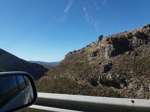
- From the coast you head towards the town of Ronda A-397.
- After approx. 50 minutes drive, you reach the high plateau and at the junction you turn left towards the village of Igualeja.
- Igualeja is just 7,5km/15min. from the main Ronda road.
- The Hike to Parauta is moderate 4,7km walk one way and it takes about 2 hours.

From the crossroad the road winds gently towards Igualeja through very rocky terrain. The harsh limestone scenery you see on the first part of the road soon gives way to a more fertile land as you approach the village. Chestnut trees with their vivid colours of orange and browns certainly dominate the landscape in autumn.


At the entrance of the village you pass a sports ground.

After you cross a bridge by the Hotel El Nacimiento and turn left,

you find the source of the river Genal (Nacimiento del Rio Genal).

It is a natural beauty spot and well worth a closer look.

What a relaxing place, and it is ideal for families to explore the natural surroundings.

Igualeja has since time began been profoundly linked to this place, it has become emblematic of the village. Until recent times the locals would come here for cooking and drinking water, to do the laundry or simply to pass time. Even today it is still a popular place for locals in their leisure time.

At the end a pathway you see a triangular opening in the lime stone rock. This is the source of Genal and depending on rainfall, the spring water either trickles or gushes out of the cave.

This spring water is the third most important water source from the aquifer of the Sierra de las Nieves. The actual source of the river is in the Sierra de Igualeja and is known as the Rio Seco (Dry river), its name changes to Genal when reaching the village of Igualeja. It is a short river and it enters into the river Guadiaro further down near the coast.


The village has been built on either side of the Genal.
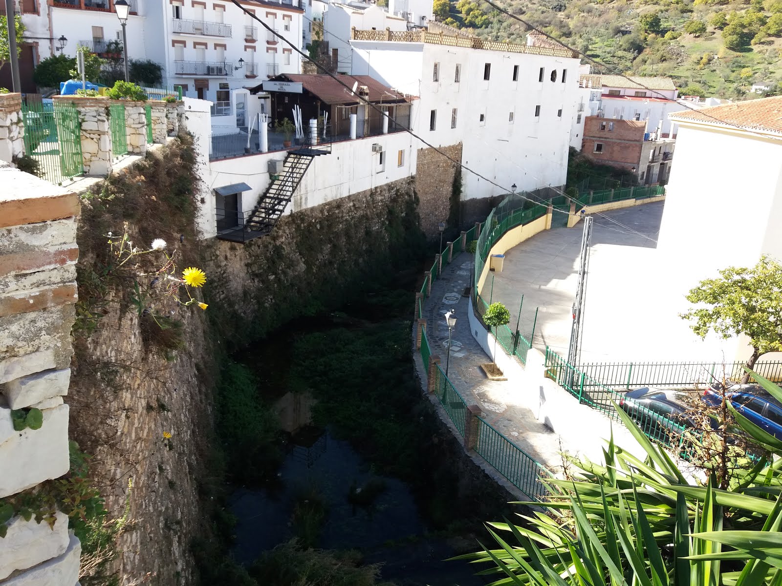
The course of water is guided through a deep channel in the village.

In autumn the chestnuts are harvested where they are collected and processed by a co-operative.
 |
| Chestnut Barn |
We left our car on the side of the main street, and strolled along alleyways to have a closer look at the village before we headed out on our hike through the chestnut forest and to the village of Parauta.
 |
| Hermitage of Divino Pastor |

Igualeja has been built along the ravine on different levels.

From the main square we headed for the adjoining Barrio Santa Rosa on a higher level.


After asking some friendly villagers for directions, we found the street Calle la Tetona and from here, we find the mule trail which leads us towards Parauta.

We leave the village behind us.

At first the track leads us uphill.

Always heading towards the north.

The path narrows.

We walk beside a fence.

As you look back you see the village Igualeja through the chestnut tree foliage.

All around us just chestnut trees.

All you can hear is the wind playing with the leaves.
It is just so peaceful.

Some of the trees are very very old.
 |
| Chestnut tree, Castaña, (Castana sativa) |
Some are even 100 years old.

The chestnut harvest is one the main incomes for the villages of the upper Genal valley and between October and November whole families get together for the harvesting.

Igalejas neighboring village Pujerra, has a processing co-operative factory where the bags of chestnuts are weighed, sorted, graded, packaged and than chilled. For first class chestnuts it is important that they are harvested and chilled in the same day.

We reach a fork in the road,

we turn towards the right and hope we have made the right choice.

Ahead and slightly towards the left you see the village of Cartajima and behind the Limestone mountains of Sierra del Oreganal.

The walk now takes us steadily downwards.
The first road sign we come across!

A pile of stones indicate that you are on the right path.
This we find on our hikes in Andalucía very often!

From here we see the village of Cartajime more clearly.
In the background the Karst rock formation of "El Risco".

On the left you see giant power lines.

Actually the path we took is parallel to the power line and we keep to the right of them.


The chestnut trees (Castañas) thrive on the hilly slopes and acidic soils of the Serrania de Ronda.


The narrow mule track leads you across a small bridge.


This giant old tree has still plenty of life left.

The enormous trunk is half hollow.

It is amazing to see the shapes of some of these old trees.


What an idyllic setting!
Surrounded by olive and chestnut trees.

Piles of wood are ready to be taken for the cold winter months ahead.

For a healthy chestnut forest, the trees are pruned regularly and the ground is kept free from unwanted plant undergrowth.

We have reached the lowest part of our route and the mule track joins with a concrete road on the other side of the stream.

From now on we climb uphill on a concrete track towards the village of Parauta.

The limestone rock is shaped by the wind and the rain, and caves are often formed.

This is typical for this area.

High above you are able to see the road we came from.


We come across some cork oak trees lining the road.

The bark (cork) has been removed recently.

It shows up the orange brown trunk.


We walk steadily uphill.

High above you are able to see the road which leads towards the villages of Cartajima, Júzcar, Faraján and Alpandeire.


The white dot in the distance that you see is the village of Cartajima and the limestone rock of "El Risco"


As we turned a corner the first houses of Paraute suddenly appeared.

From here we got a good view of the dramatic limestone mountains of
Sierra del Oreganal.

This sign explains that they are studying the impact of chestnut hornets in this region.

The village of Parauta has a population of about 250 and therefore is one of the smallest villages of the Upper Genal valley. With a surface area of 44 square/km the municipal borders of Parauta stretch far inside the nature park of Sierra de las Nieves. By car you reach the village from the junction near the petrol station on the San Pedro-Ronda road A-376.

The town hall (Ayuntamiento)

As we walked through the village we noticed many informative wall tiles.

This sign talks about the villages Moorish past

and this one how olive oil is produced.

We found many intriguing nooks and crannies.


In Parauta we noticed most interesting looking mail boxes!

After the pleasant hike and a brief look around the village of Parauta we looked forward to finding a nice restaurant.

And we did!!

The restaurant Mesón Anafe is set on various levels and has a traditional country decor, with a warm and welcoming atmosphere.

It served hearty, mountain dishes.
Just right for hungry travellers and for cold winter days.
 |
| Mountain dish (Plato de la Serranía) |
 |
| Wild boar in wild mushroom sauce (Jabalí con Salsa de Setas) |
Very delicious and tender!!
 |
| Tomato salad (Ensalada de Tomates) |
After the meal we headed back up through the village to look for the path we came on.

What a beautiful pine tree, Pinsapo (Spanish fir).

The village of Parauta gave a winning impression,
and we certainly will come back soon to explore more of it.

On our way back we saw a flock of sheep as they grazed under the chestnut trees.


As we retrace our route we feel in harmony with nature
and privileged to have found another beautiful part of Andalucía.


Across a field road we carry on walking on the mule track.

We reach the outskirt of Igualeja.

A last look across the sloping hills and the chestnut forest.

We walk through the barrio Santa Rosa

and we head towards the main road which leads into the village.

From far we can see our car as we head back to the village center. it was a memorable trip and we sure will be back soon. Serranía de Ronda has something to offer at any season of the year.

The route from Igualeja to Parauta:
 |
| Wikiloc: Igualeja to Parauta |
How to get to Igualeja:

Related link: The Copper Forest
No comments:
Post a Comment