A Walk to the Waterfall and to the Springs of Balastar.
"Ruta de Las Chorreras, Balastar"


Prologue:

The Hike to the waterfalls "Las Chorreras, Balastar" is an easy/moderate 4,5 km circular walk.
You have to cover twice an altitude difference of 140 meters.

The walk takes you along irrigation canals and alongside vegetable gardens (Huertas). It can be done anytime of year, but bare in mind that after heavy rain the path could be wet and slippery.
At times it is quite steep. We enjoyed the colorful time of autumn.
The small village of Faraján is located 24 km south of Ronda, at an altitude of 641 meters in the Upper Genal river valley of the Serranía de Ronda. The neighboring villages are Alpandeire and Júzcar.
The Muslim Berber settlers colonized the mountain region of Serranía de Ronda from the 8th Century and their tribes formed small villages, set in the middle of the hillsides. It is thanks to these early settlers of the Serranía de Ronda, who built the irrigation canals and made this land fertile, that makes the Genal region "Valle de Genal" so colorful and picturesque.
Hemingway defined the white village of Faraján as
"The white swan on a pond of hope".
"The white swan on a pond of hope".
Faraján is known for its terraced gardens (Huertas) and for the famous black pigs "Cerdo Ibérico", which roam freely under the Holm Oak trees (Encinas) in search of their favorite food the acorn (Bellotas).

You have to cover twice an altitude difference of 140 meters.

At times it is quite steep. We enjoyed the colorful time of autumn.

Directions:
- From Marbella AP-7 you drive west and in San Pedro de Alcántara you turn towards Ronda A-397.
- After approx. 48 km/45 minutes drive, turn left onto MA-7306 towards Parauta and Cartajema. You find yourself on the Legacy Route of Fray Leopoldo de Alpandeíre (Ruta del Legado de Fray Leopoldo).
- You bypass the villages of Cartajema and the blue village of Júzcar, in the upper Genal valley.
- After about 62 km and 1h30min, you reach the village of Faraján.

It is very scenic , as you drive through the rugged terrain of the Sierra de las Nieves and the forests of Aleppo pine, Cork and Holm oaks, as well as the Chestnut orchards.

Faraján in Arabic (Farra-jan), "place of delights", where, apparently, the retired Moorish hosts came to rest. Archaeological sites of ancient Arabic settlements, like Balastar, Chicar, Majada del Juez can be found here.
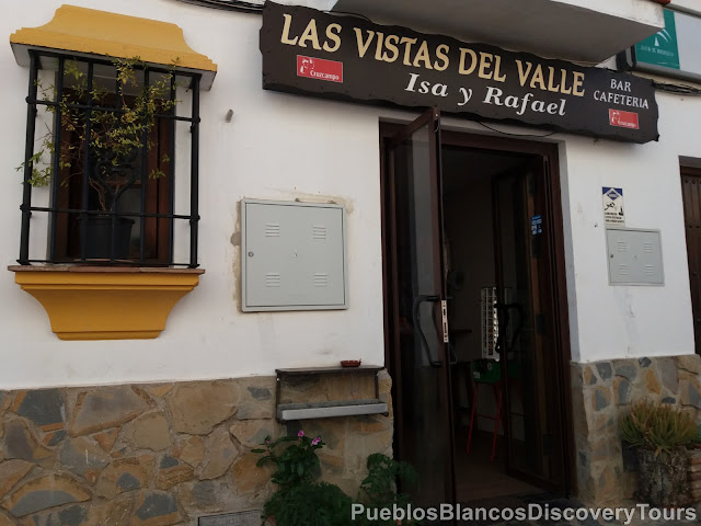

Before we set off on our hike, we stopped for coffee in the restaurant "Las Vistas del Valle" in the street "Calle Chorchuelo". Inside the restaurant we admired the panoramic views out of the large windows.

From here you look out onto the pathway which leads down to the waterfall
"Las Chorreas, Balastar".
Across the valley you are able to view the white villages of
Algatocín, Benalauría and Benadalid.

We had a brief look around the church square.

The church of Nuestra Señora de Rosario in Faraján was built in the 16th Century on the remains of an old mosque.


The villagers decorate the orange trees with coloured woolen ribbons.

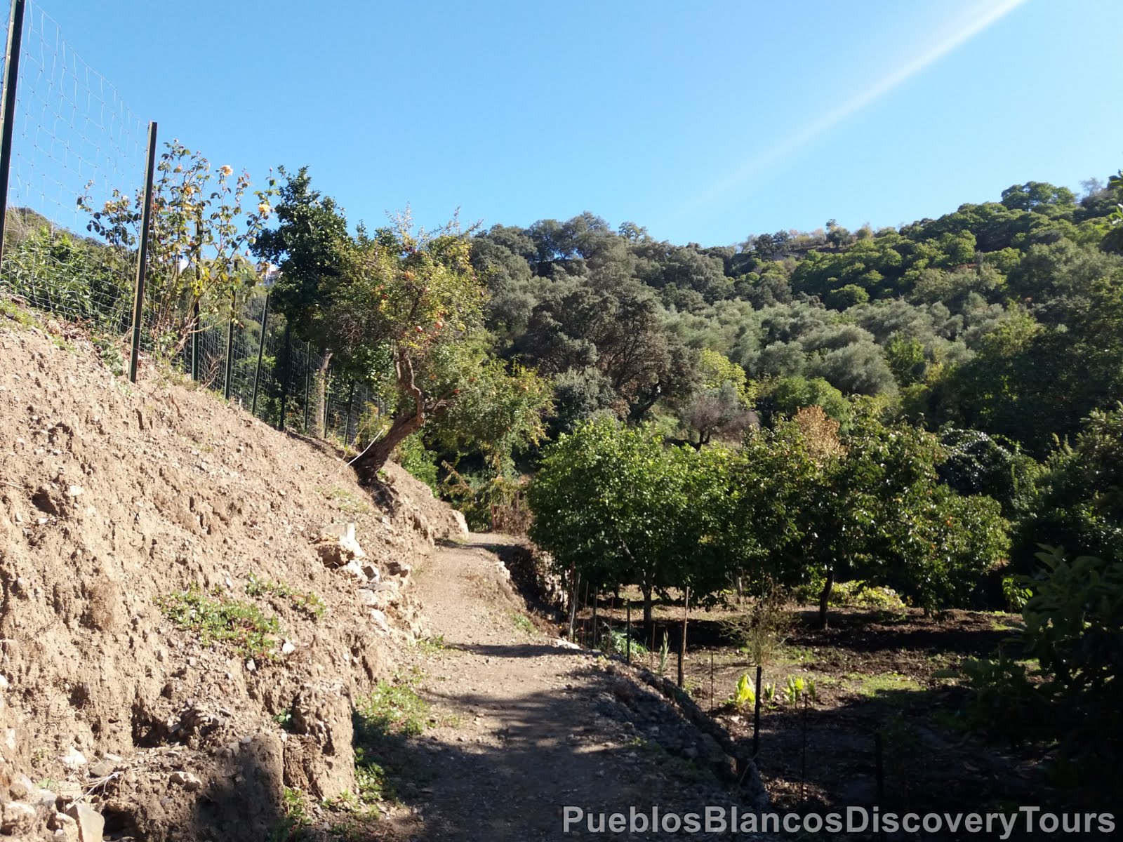
Between the church square and the restaurant we find the little alleyway which leads to the walkway Ruta de las Chorreras.

This way leads us downwards and out of the village.

We immediately enter into a world where the villagers have their gardens (huertas).

A chestnut tree full of ripe prickly fruit.

We overlook a lush green valley.

A view towards the west.
On the horizon the karst mountains of "Sierra de Líbar".

The village of Faraján high above us.
 |
| Hemingway defined the white village of Faraján as "The white swan on a pond of hope". |
 |
| Poplar trees (Populus alba) |
In this region you find many Holm oaks (Encina).

Farm house among the lush greenery.

Straight ahead and high above us, the pine forest covered hill
of "El Romeral".

Chestnut trees have been cultivated for centuries all around the river valley of the Genal.

It is in the autumn that the Copper Forest (el Bosque de Cobre) of the Serranía de Ronda, comes alive. Not only is the harvesting of chestnuts in full swing, and many businesses in the region of the Genal river valley depend on it, but also the natural phenomena, when the leaves of the chestnut trees change their colours from green to yellow to orange and brown, can be observed.

At the way sign we turned right towards "Nacimiento de Balastar".

The springs of "Balastar"

Which turned out to be 2 stone wells, where the spring water is collected.

The Arabic settlement of "Balastar" was named after the stream and at the time of the Christian reconquest around 1485, counted 15 families, but in the 15 century the Muslims left the area and Balastar was left deserted.

The spring waters flow underground only to reappear as a magnificent waterfall.

We return to the way signs and turn left to "Ruta de Las Chorreras",
which leads us further downwards.

The footpath follows a water canal.

The water of "Balastar" is used to irrigate the horticultural gardens.

The irrigation canals were first constructed by the Moors.

This is the point where waters run over the edge and also the top of the waterfall, as we found out later.

As we carefully proceed downhill, we wonder....

about the people who walked along the same path and worked the land throughout the centuries, it certainly is not an easy task due the steep terrain.

On the way to the waterfall and springs of Balastar you will pass many small terraced vegetable gardens (Huertas) and orchards with a great variety of fruit trees.

Above, huge calabash lay ready to be picked
Below, the bright orange fruit of Persimmon.

In the distance the villages of Benalauria and Benadalid.

Remains of a mill dating back to the times of "Al Andalus"

Quite a mythical setting!

The path is quite steep!

Imagine you have to take the crop up on foot up to the village!

Water is gushing along canals everywhere.

As we turned another corner

we noticed a picnic table under a lovely walnut tree

and then a magnificent waterfall came into sight.
It is certainly amazing to see the water gushing down the cliff of approx 20 meters.


You can see the porous consistency of the limestone rock.

The water has formed many nooks and crannies, and in one of the hollows there is a small angel figure.

The rock is covered with moss, lichen and other water plants.


After we had a rest and soaked in the tranquil surroundings, we walked on.

A view along the lush river valley.

Another look back before we carried on.

We followed the sign to the 2nd waterfall (Chorrera 2).

The path leads along a fence.

The vegetable garden after the summer.

Now you find yourself heading towards the other side of the valley.

The moist underground is an ideal condition for mushrooms.

From here it is another 390 meters to the 2nd waterfall.

Across the valley, the waterfall and the old mill.

A good view of the terraced gardens

and to the "Pueblos Blancos" on the road Gaucín/Ronda A-369.

We had to follow the path steep down the hill

and there after, along side a stream.

Surrounded by such a variety of fruit trees, and well hidden away in the "campo",
it is what the garden of Eden must have been like.

Apart from the usual orange and lemon trees, we saw Avocado, Pomegranate Quince and many more....

 |
| Pomegranate tree, Granado, (Punica granatum) |

 |
| Avocado tree, Aguacate |
 |
| Quince, Membrillo |

but the lush vegetation and fallen trees, would not allow us to get any nearer.

It certainly looked like the heavy winter rains, had caused some havoc in this area.

This cave makes a perfect hideout for some wild animal.


A view across the valley from whence we came from.

A view along the river valley of "Balastar".

The rest of the way we had to follow the path steeply uphill.

Fancy having to walk up and down to get your vegetables.


 |
| Strawberry tree, Madroño, (Arbutus unedo). |

We have reached the top near a viewpoint

It is an easy stroll from the village to get to this Mirador.

From here we look down and across the valley

The mystical world of Balastar

It is such a beautiful lush countryside and we find ourselves privileged to be able to sample some of its hidden treasures.

Overlooking a chestnut grove and towards the west.

It is an easy stroll back to the village from the Mirador.

A last view over Faraján, but we certainly will return.

Map of the hike to Chorreras, Balastar
 |
| Wikiloc: Farajá, las Chorreras, Balastar |

Related blogs: Serranía de Ronda
Related links: The lost villages of the Valle del Genal
No comments:
Post a Comment