The Walk to the Vultures Feeding Ground
Sendero La Acedía - Pasada del Pino Sl-4

Prologue:
Whenever we have stopped at the viewpoint Mirador Peñas Blacas in the past, which is on the road MA-8300 leading towards the village of Casares (Costa del Sol), we overlooked a very lush valley "La Acedía", scattered with small fincas and nice homesteads. We were always intrigued about this area and so we decided to have a walk through it, and to find the vultures feeding ground.
The hike leads us through a mature cork oak forest which gradually turns into a pine forest until we reached open barren land with low shrubs at higher altitude. It was here where we found a fenced in area set aside as the vultures feeding ground. The walk was fairly easy as you walk on a well maintained country road throughout the valley of "Acedía". The feeding ground is at an altitude of approx. 440 meters. Throughout this walk there are fantastic panoramic views.

Descriptions of the routes:
The route begins at the junction of the MA-8300 road with the path that accesses the Acedía valley, and crosses the local mountain of the same name. there are two options: the long route and the short one. Both routes go along a trail surrounded by Cork Oaks, the predominant tree in this landscape. As the itinerary approaches the foothills of the Sierra Bermeja the landscape changes, as the Cork Oaks are replaced with Resin Pines, a consequence of a dramatic change of soils. From this point, the short route (SL-4A) returns to the starting point, while the long one (SL-4B) keeps approaching Sierra Bermeja through the hollow known as Pasada del Pino. The long route passes by a landfill (vulture feeder). The last part of both routes is identical.
The mountain backdrop of the entire route is Sierra Bermeja (the scarlet mountain) one of the best world exhibitions of peridotite, the dominant rock of the upper part of Earth's mantle. These types of rocks generate soils that are highly toxic for plants; therefore, only plant species specially adapted to these hostile conditions can grow,a characteristic that makes them unique.
Information taken from board.

Sierra Bermeja is located in the south west part of Malaga province, between Estepona on the coast, Casares in land to the west, and the Genal Valley to the north. The Sierra Bermeja is a mountain range with an average height of 1000 m (its highest point being 1500 m), covering 1236 ha. It is an area that has undergone major volcanic activity; the rocks are rich in the olivine mineral. Rainwater has oxidized the iron and the magnesium present in the rocks and the iron oxide has coloured the rock reddish-ginger, a hue that gives the sierra its name.
The massif of the Sierra Bermeja is the second greatest outcrop of plutonic rock in the world. Because of its peridotite nature which refers to its peculiar shade of red, this particular lithology allows only plants species of a very specialized type of substrates to grow, like the black pine (Pino Negro) and the unique Spanish fir (Abies Pinsapo) and other endemic species.

Directions:
- Coming from Marbella you have two options, you can take the Toll road Ap-7 or exit the A-7 towards San Pedro de Alcántara, Estepona, Algeciras.
- In Estepona we take the motorway exit 153 for A-7 towards Algeciras, Cádiz.
- At the roundabout take the 3rd exit Pista Colada de los Molinos a E, after 5,2 km you reach a crossroad, turn right onto Ma-8300.
- The turnoff to "La Acedía" is approx. 600 meters from the restaurant "Venta Victoria".
- We parked the car near the information boards and walked from there.
Click on the link below to see more details about the Hike.
 |
| Wikiloc: Casares, Sendero La Acedía+Pasada del Pino |
- The Hike is a semi circular route of about 10 km on a well maintained country road, to an altitude of 440 meters.

We turned towards the left and followed the orange arrows.

The first 2,5 km we walk through a pristine forest of cork oaks (Alcornoque), Holm oaks (Encinas), wild olive trees (Acebuche) and many different types of shrub.

This majestic old tree makes a unique landmark.

this takes place every 9-12 years.


A loud hammering filled the air and we were lucky to observe a woodpecker as he hammered on an old tree.

In spring, the air is filled with the sweet scent of the yellow flowers of the
Broom bush (Ginesta).

We pass an abundance of multi-coloured wildflowers along the route.

 |
| Jerusalem sage, Matagallo (Phlomis purpurea) |

Ahead of us the natural area of "Los Reales de Sierra Bemeja".

Look at the size of this cork oak tree's trunk!

I wonder how old this tree must be.

We cross a little stream,
surrounded by dense shrubs and tall eucalyptus trees.

We leave the river valley and follow the road uphill.

Cork oak tree, Alcornoque, (Quercus suber)
The cork oak, (Alcornoque) is native to the western Mediterranean region, (Spain, , Italy, France, Morocco,Tunisia, Algeria, and including Portugal). The use of the cork has a long history, dating back to the Egyptians, the Greeks and the Romans, for sealing jars, roofing and making beehives and many other things. In 17th century a French Benedictine monk (Don Pierre Pérignon) was considered responsible for the use of cork as stoppers for bottles to preserve wine, this method is still widely in use today.
The art of harvesting the cork from oak trees is done by skilled local people (los Corcheros). The bark is stripped of the stem every 9 - 12 year intervals, when it has reached a thickness of 3 cm, in spring or early summer.

When the bark has been recently been stripped away, the orange/red stem is visible.

A view west and towards limestone rock of the Sierra Crestellina.

At a crossroad, we take the road to the left leading uphill.

Green and white stripes, this indicates we are on the right track.

We follow the sign towards "Pasada del Pino",
this route will lead us to the vultures feeding ground.

Throughout the spring various types of rock-roses (Cistus) can be seen


 |
| Sword lily or Field gladiolus, Gladiolo, (Gladiolus italicus) |
A view across the valley and south, towards the coast.

Set within the lush valley of La Acedía" are country houses (Cortijos).


In the distance we can make out the peak of Sierra Crestellina.

The reddish mountain of Sierra Bermeja and Pico de los Reales.

A view east and on the horizon the Mediterranean sea.

At this altitude the land is more barren, nevertheless it is astonishing to see such a variety of blooming plants in this sort of terrain.


The delicate blue flowers of a blue eyed grass.

 |
| Tassel hyacinth, Leopoldia comosa, (Muscari comosum) |
We approaching the feeding ground for the birds of prey.

This fenced in area was set aside by the Andalusian government as a feeding ground for birds of prey. In 2002 an organisation RACAC (Red Andalucía Comederos Aves Carroñeras) was created, to allocate feeding grounds throughout the Andalucían provinces, with the help of the European Union, to help the declining population of all birds of prey. The main objective is to complement the natural diet, whilst complying with the current sanitary measures.
Among the species which are benefiting from this kind of human intervention are the Griffon, Black and Egyptian vultures as well as the Red and Black Kites and the Royal and Imperial eagles.

The iconic Carrion bird the Griffon vulture (el Buitre Leonado), can be found in the rocky terrain of the Sierra Crestellina, which is one of the most important locations in the province of Málaga. These majestic birds can be observed flying effortless between the Sierra Bermeja and Sierra Crestellina by Casares and beyond. The powerful wingspan of more than 2.50 m allows them to gain height with hardly any wing movement. These scavengers are vital for a healthy environment because they clean the area of cadavers which can cause infections for other animals.

A view across the allocated feeding ground.

We walked further up another 200 meters.

The panoramic views are stunning.

A view back towards the feeding ground and the road we came on,
on the horizon the Mediterranean sea.

In the distance towards the west, the limestone ridge of Sierra Crestellina.

A view north across the barren land towards
"Los Reales de Sierra Bermeja".

.....suddenly the sky was full of Griffon vultures (Buitre Leonado)
as they glided soundlessly overhead.

We observed for a while, and then decided to walk back the same road.

At the junction we turned left towards "Garganta de Acedía".

This road leads downwards towards the river valley of Acedía.

Again we find ourselves surrounded by lush vegetation.

The sign reads Garganta de Acedía 3,3 km.

This stretch is also part of the great walkway around Malaga province.
"Gran Senda de Málaga".

Cork oaks line the road side.


Ivy has almost completely covered this pine tree.

These large birds can usually be observed in late afternoon and early morning.


A large estate with well maintained lawns.

We followed the road onto the other side of the valley in the direction of our starting point.

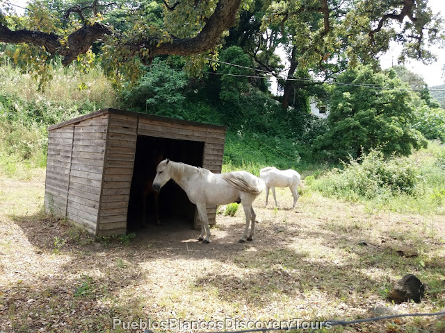
Andalusian horses.
We found a nice picnic spot in a clearing.

Some more wild flowers along the way.


The evening sun reflects the Sierra Bermeja, so scarlet and serene.

Map of the walk
How to get to La Acedía

No comments:
Post a Comment