Mirador de Luis Ceballos
and the Peak of
Peñon de los Enamorados


Prologue:
The village of Yunquera is situated 50 km to the north of Marbella and 38 km to the east of Ronda.
On a lovely warm February day we decided to go for a hike near Yunquera and into the Sierra de las Nieves Nature Park. The hike took us through a large forest of Pinsapo, the unique Spanish fir trees which are native to this region of Andalucía.
This area is known for its outstanding beauty, not only for its wonderful views, but also for its biodiversity.
Quite often you can see the Iberian Ibex, Cabra Montes, on the rocky slopes of the limestone mountains.
The hike itself was moderate to more difficult but in all we enjoyed every moment of it.
Note: When walking to the high plateau and onto the peak of Peñon de los Enamorados be sure to wear appropriate clothing as in the winter months you might find snow in this part of the mountains ,and of course take plenty of water with you. If there should be a fog coming up, make sure you find yourself on a proper pathway.

Directions:
- From Marbella A-7 you take the road towards Ojén A-355.
- Drive onto Monda there you turn towards Guaro/Ronda A-366. You bypass the villages of Guaro, Alozaina and Jorox.
- You reach Yunquera after 47 km and approx. 1 hour drive.
- In Yunquera you stay on the Ronda road until you reach a roundabout, where you take the 2nd turning towards Sierra de Nieves Nature Park (Parque Natural Siera de las Nieves) and the Sports ground (Complejo Deportivo).
- From the Roundabout you drive for about 5 km on a forest road until you reach a gate which is the entrance to the Nature Park.
- It is from there where we started our hike.

The Hike is divided into two parts.
- The 1st part is moderate 2,5 km walk on a forest road to the Mirador Luis Ceballos /1200 m).
- The 2nd part is certainly more challenging. It is about a 3,2 km hike along a narrow foot path and of 200 meters elevation, to the peak of Peñon de los Enamorados (1460 m)
- The complete hike was 11,5 km long and it took us 5 h 20 min. including time for a snack and picnic. From the starting point at 1092 meters you will reach a height at 1460 meters at the top of Peñon de los Enamorados.

As we left the village we passed Almond trees full in bloom.

A road sign directing us in the right direction.

Various trees line the road, like Aleppo pine, Cork and Gall Oaks,
chestnut trees, and many more.

We carefully drive up a well maintained forest road and become aware of the magnificent nature area.

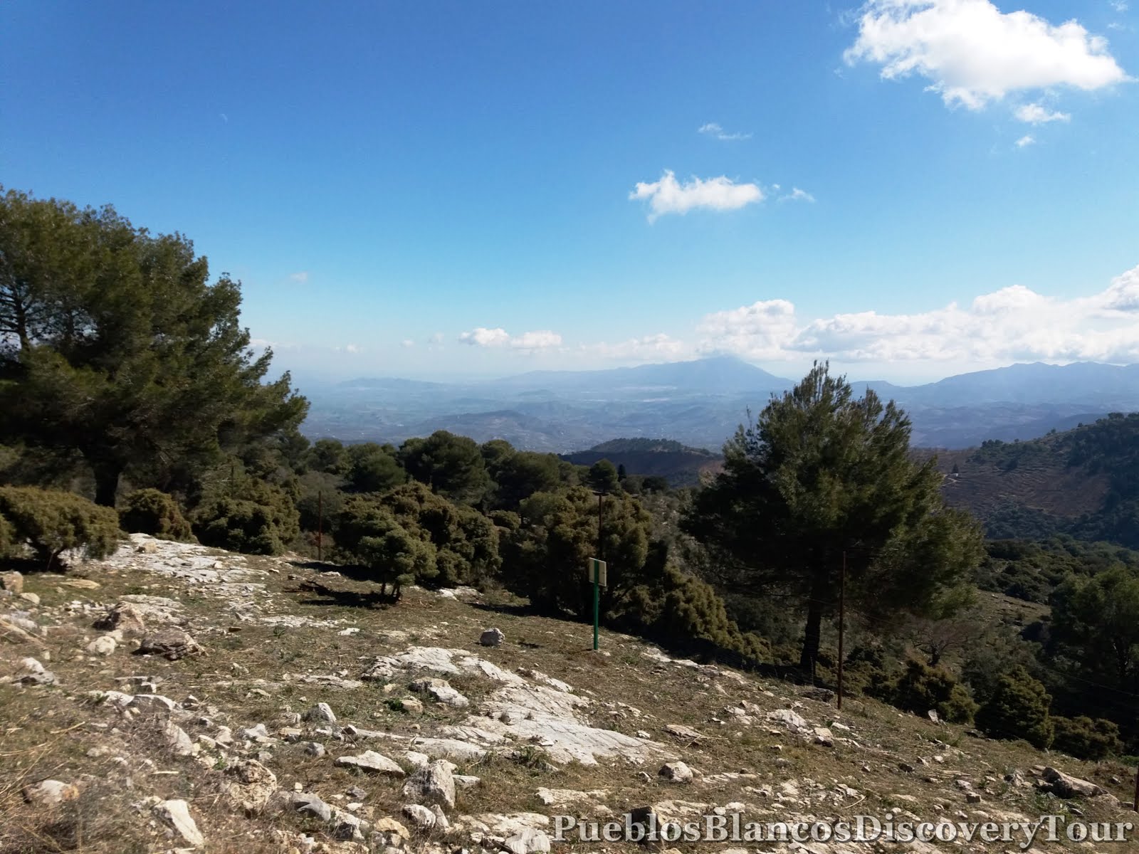
This view is towards the east and the coast of Málaga.

We left our car at a small car park near the gate and started our hike.

An Information board informing you about the
Sierra de las Nieves nature park.

Sierra de las Nieves was declared a Nature Park in 1989, it is located in the western part of the Málaga Province, bounded to the south by the western Costa del Sol, to the east by the Guadalhorce Valley, to the west by Sierra of Ronda and to the north by the district of Guadalteba.

El Pinsapar, Spanish fir

The Spanish fir, El Pinsapar (Abies pinsapo) is a species of fir found in southern Spain and northern Morocco. Related to other species of Mediterranean firs, it is considered the Andalusian National Tree, and is native to the Andalusian mountains. It appears in the Sierra de las Nieves by Ronda ,and Sierra Bermeja in the province of Málaga, and Sierra de Grazalema in the province of Cádiz at altitudes of 900 - 1,800 meters.

We took the direction towards the Mirador de Luis Ceballo.

As we turned a corner we looked back towards Yunquera.

The rolling hills are covered with olive trees and chestnut trees.

Farm work was in full swing as the undergrowth was being cleared in the
chestnut groves.

High above us we see the limestone peak of Pico del Jarro

In a clearing we saw a circular pile of stones,

we wonder what the purpose is.

Apies pinsapo can reach a height of 20 - 30 meters.
They have to withstand very harsh conditions, very cold winters as this area is very often covered in snow, and very hot dry summers. They are able to pick up the moisture from the air with their short dense needles.

In the distance you will see Sierra de Mijas and Sierra de Coin.
The village of Yunquera in the foothills of Sierra Cabrilla.


It was a pleasurable 2,5 km walk to the viewpoint.

You are standing at 1200 meters above sea-level,
the panoramic views are stunning.

Luis Ceballos y Fernandez de Cordoba (1896 - 1967)
Engineer of mountains, Botanist, Professor and Academic

Poem taken from the rock carving.
Do not ever avoid contact with the mountains, go to the fullness of curiosity and spirit of observation, be willing to see and feel, appreciating all the details of your moment.

An information board explaining the facts about the significance of the
Pinsapo trees in this area.
There are some stone benches for you to take a rest and enjoy the ambience.

Cabra montes, Iberian Ibex
La reina de las cumbres, the queen of the peaks

This species of mountain goat Cabra Montes is unique to the Iberian peninsula and about 35000 are found in the mountainous region of Andalucía. They are fully adapted to the rocky slopes and harsh climates. Hot dry summers and cold winters with snow covered peaks.

To the right of the viewpoint you find the start of various hiking trails.

The board explains of the route to
Peñon de los Enamorados.

We follow a narrow footpath along the mountain side.


Brown wire mesh protecting small trees.

Now we are surrounded by herbal shrubs like Rosemary, Lavender, Rock-roses, Broom or Genista and many more.
 |
| Rosemary, Romero |

A quick look back from where we came, then we carry on.

A wooden pole indicates that we are on the right track.

From now on it goes steadily uphill and into the Pinsapo forest.

A view along the valley.

In the distance we see the limestone peak of Pico del Jarro

On the other side of the valley we see the track we came on.

The view along the valley to the east and towards the coast of Málaga.


It is a shame that the rock-roses are not in bloom yet.

At a steady pace we walk upwards on a well used path.


Occasionally we come across a wooden pole with an arrow on it

or a pile of stones, which are signs which help us to stay on the right path.


From now on the path becomes slightly steeper,
but not too difficult.

Marvellous views along the valley and towards the
Mirador Luis Ceballo and the Bay of Málaga.

Pinsapos are certainly magnificent trees, so perfectly shaped.

It is most unusual how this tree has grown.


Across the valley and the path we came on.


We have covered quite a distance already.


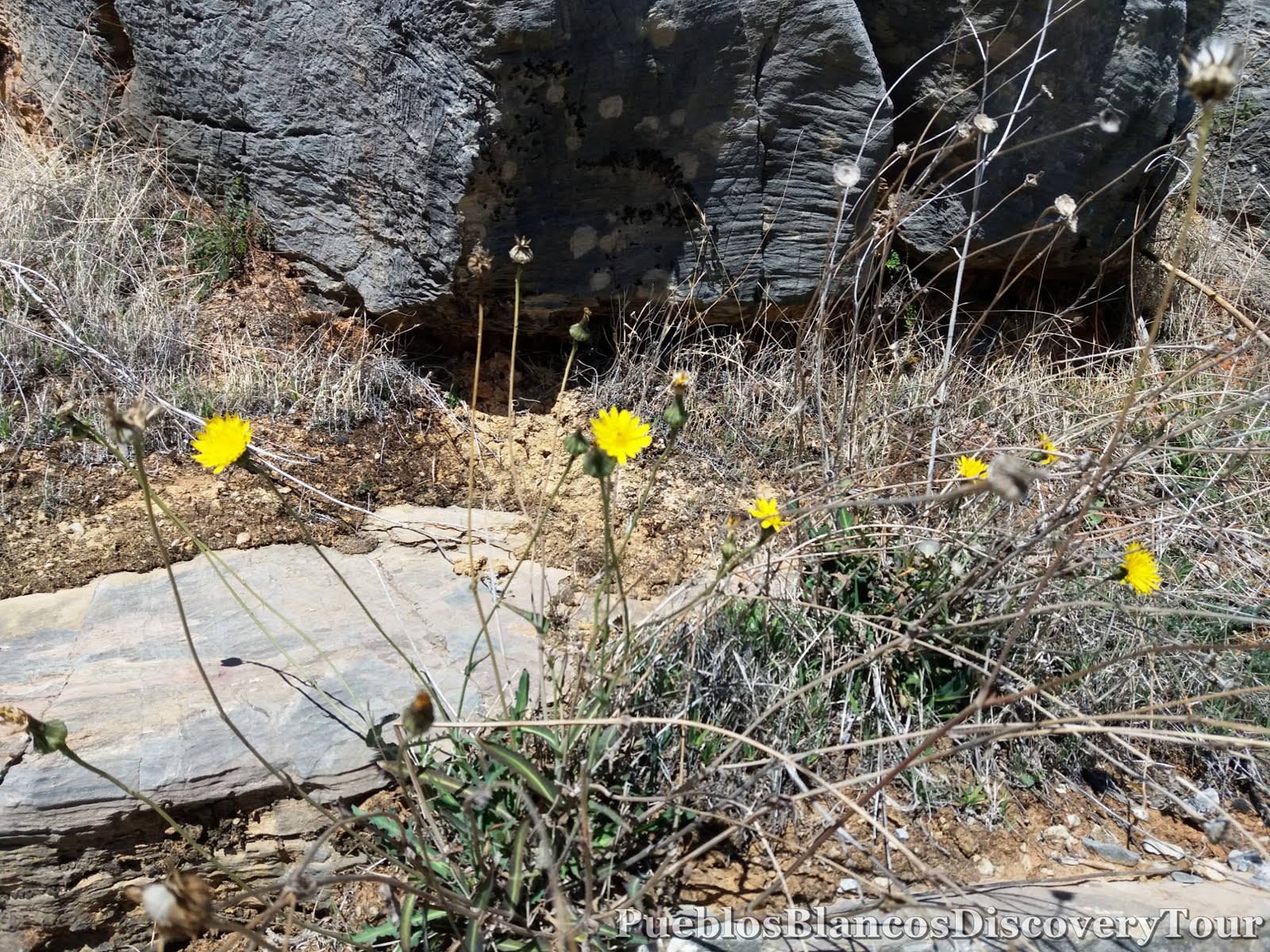
Between and on the rocks you find lichen, moss and succulent plants.

If you rub the leaves of this plant between your fingers
it had a very strong aromatic smell.

Curry Plant, Perpétua-sas-areias (Helichrysum italicum)
It is a herbal plant with yellow flowers, and it is used for medicinal purposes and as a fixative in perfumes, it has an intense fragrance.
 |
| Thistle |

The higher we get the rockier the path becomes.


From here we look back towards Yunquera and the Mirador of Luis Ceballo.

We have reached a height around 1300 meters above sea-level.

The trees certainly seem to struggle here.

We see lots of trees which have fallen, full of lichen and fungus.

Maybe they are suffering from climate change!

It felt sad to see so many ill trees.

At one stage we had to climb over the trees to be able to carry on with our hike.


We have nearly reached the top.

As we look over the tree tops along the valley,

and over this magnificent ancient forest,

we feel so humble and privileged to have found this place.

We have reached the high plateau and it is breathtaking.
Another stone for the pile.

It is quite an interesting area.

Wonderful panoramic views.

Unexpectedly we came across some historic facts.

Eras are paved circular areas located in well vented places.
They were used by farmers for threshing cereal harvests.

Life for the mountain people was very hard due to the harsh environment. The farmers had to carry the cereal bundles on their backs or by pack mule to this high plateau. They chose this location for its airiness, the wind helped to separate the grains from the husk .
If you look closely you can see the circular areas.

It is very noticeable where the treeline gives way to the rugged terrain of the Karst mountain.


Exploring this natural wonder, made us feel so small.

Peñon de los Enamorados (Lovers peak)
Exhilarating!
Feeling on top of the world!


On the side of the cliffs there are various caves to be seen.

The view from the peak down to the plateau of Era.

Certainly stunning views towards the bay of Málaga

At a height of 1460 meters the 360º
panoramic views are just amazing.


To look at this rock formation,
makes you wonder what kind of natural forces have shaped them.

Limestone is a sedimentary rock, composed mainly of skeletal fragments of marine organisms such as coral, molluscs and crustaceans. Its major materials are the minerals calcium carbonate.

A Geologists dream

As we returned to the plateau we found an ideal place for a picnic.

This dark coloured rock was surprisingly warm.


The rock displayed unusual circular holes.

It looks like its been struck by giant hailstones!

We walked carefully over the rocks

as other areas showed crevasses.

Karst is a topography formed from the dissolution of soluble rocks such as limestone and dolomite. Bizarre land-forms are created mainly by water draining and circulating underground, this is the result of chemical erosion of bedrock.

We were reluctant to leave this unusual place but we wanted to get back before it got dark.


Back at the Viewpoint, Mirador Luis Ceballos.


We had another look around and soaked in the views before the sun disappeared behind the mountains.

 |
| A blooming Rosemary bush, Romero |
 |
| Walnut tree, el Nogal |
Map of the hike
 |
| Wikiloc: Peñon de los Enamorados |
How to get to Yunquera

No comments:
Post a Comment